
Typhoon Maysak Starts Weakening

The GPM core observatory satellite passed above typhoon Maysak in the western Pacific Ocean on April 2, 2015 at 2343 UTC. GPM's Microwave Imager (GMI) found heavy rain in Maysak's northwestern side but the typhoon had weakened from it's peak intensity of over 130 kts (150 mph) to about 115 kts (132 kts) at the time of this satellite view.
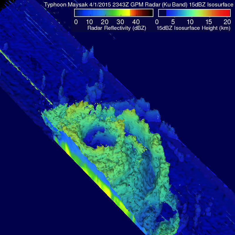
GPM's Radar (Ku Band) was used in this 3-D view to show vertical structure within typhoon Maysak. This view, looking toward the southwestern side of Maysak's eye, shows that the eye wall was eroding on that side. Vertical wind shear has contributed to typhoon Maysak's continued weakening and the Joint Typhoon Warning Center (JTWC) predicts that Maysak will be a tropical storm when it hits the Philippines in a couple days.