Typhoon Nesat Threatens The Philippines
The Philippines have already felt the effects of two typhoons and two tropical storms this year. The TRMM satellite had an excellent early evening view of another typhoon called Nesat on 26 September 2011 at 0856 UTC that is moving toward the Philippines. Typhoon Nesat formed in the Pacific Ocean east of the Philippines 23 September 2011 Nesat is predicted to hit the Philippines within 24 hours as a powerful category two typhoon with wind speeds of about 90 kts (~103.5 mph).
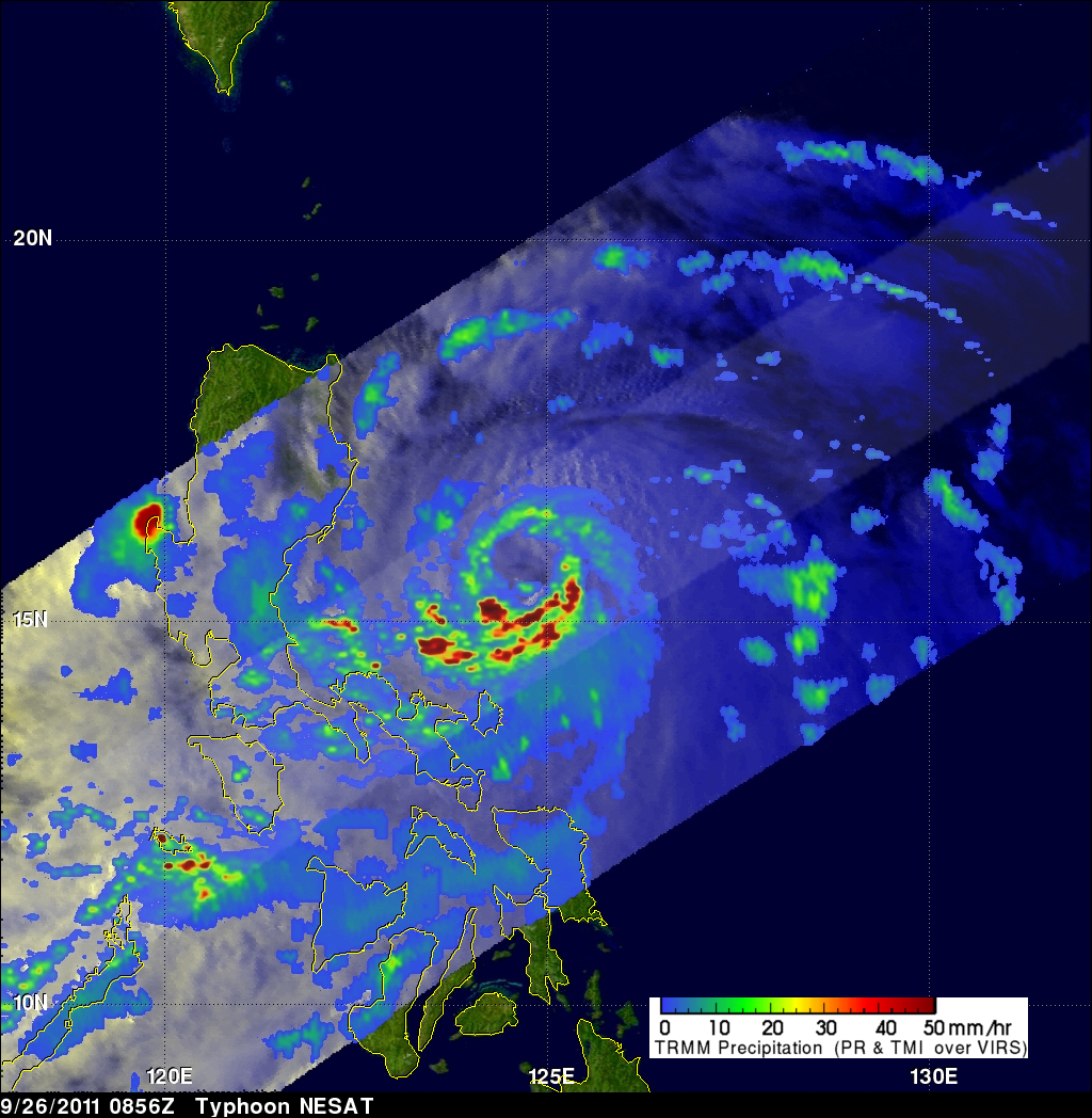
The image above shows a rainfall analysis derived from TRMM'S Microwave Imager (TMI) and Precipitation Radar (PR). Those data were overlaid on a combination Visible and Infrared image from TRMM's Visible and InfraRed Scanner (VIRS).
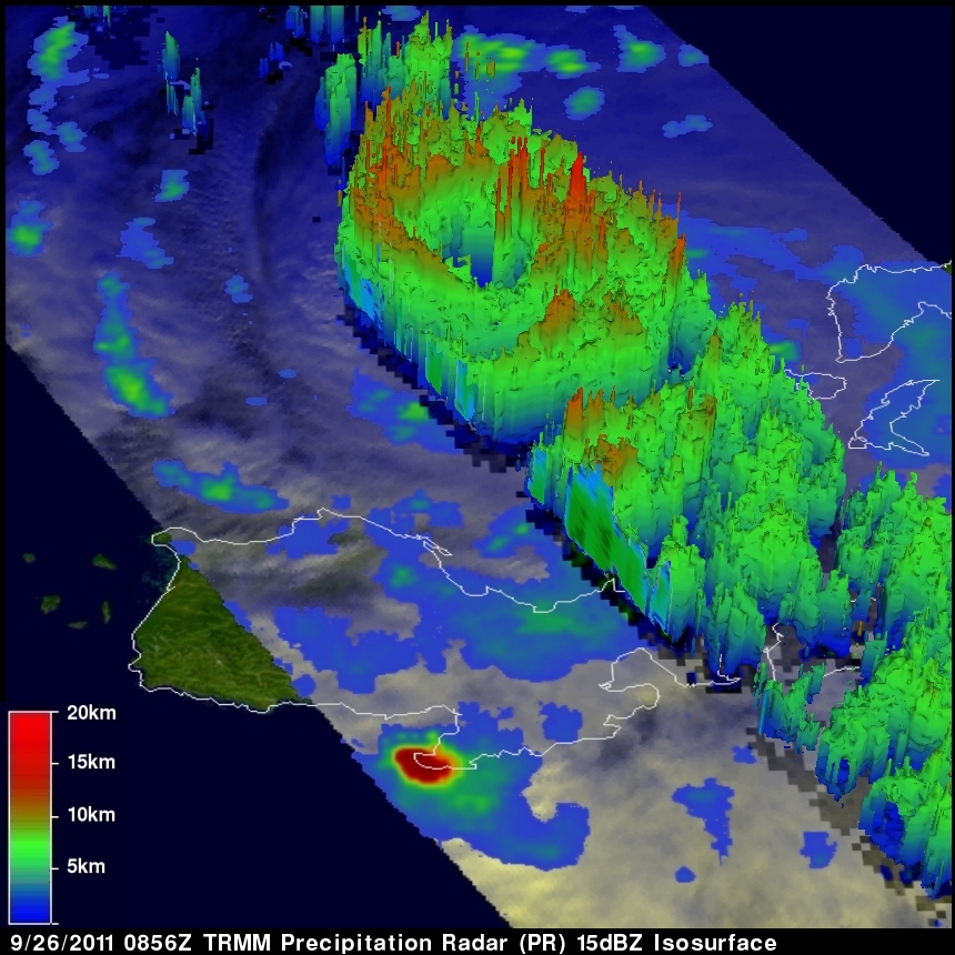
The image below shows a 3-D view of the typhoon's structure using data from TRMM's Precipitation Radar (PR) data.