
Typhoon Pakhar Moving Toward Vietnam
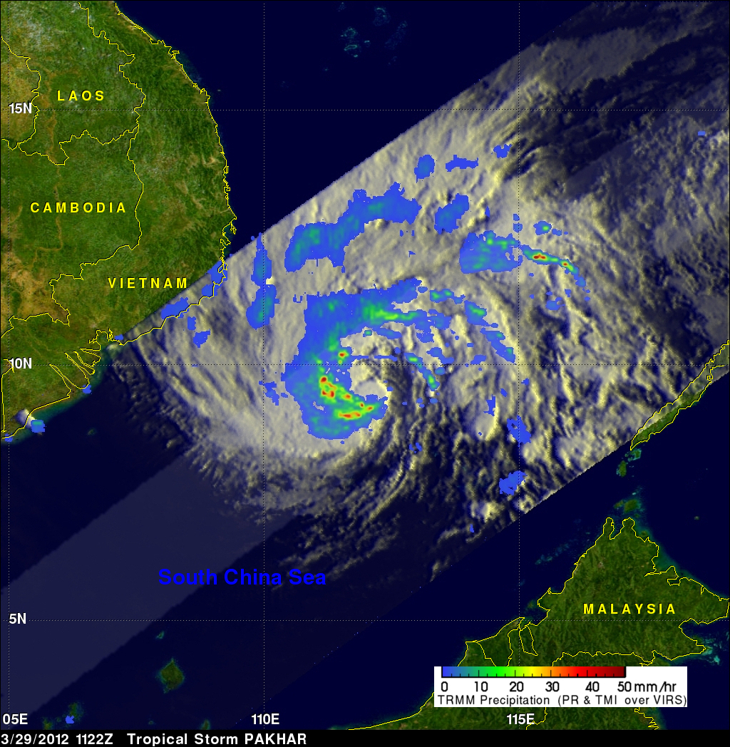
The TRMM satellite flew almost directly over a newly formed tropical storm in the South China Sea on 29 March 2012 at 1122 UTC. Pakhar is the first typhoon to form in the northern hemisphere this year. The intensifying storm had wind speeds of about 45 kts (~52 mph) and was moving toward the west-northwest when viewed by this TRMM pass. Pakhar is predicted to be stronger with wind speeds of at least 60 kts (~69 mph) when it crosses into southeastern Vietnam on 31 March 2012.
The rainfall analysis above used data from TRMM's Microwave Imager (TMI) and Precipitation Radar (PR) instruments. It shows that moderate to heavy rainfall of about 35 mm/hr (~1.4 inches) was located in an area around Pakhar's southwestern side. TRMM Precipitation Radar (PR) showed that some of these storms were reaching to heights of about 13km (~8 miles) above the ocean surface.