Typhoon Phanfone Heads Toward Japan
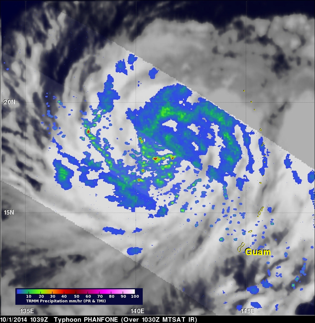
An intensifying typhoon called Phanfone that originated east of Guam on September 28, 2014 is headed toward southern Japan. The TRMM satellite crossed above typhoon Phanfone on October 1, 2014 at 1039 UTC. Rainfall that was made from TRMM's Microwave Imager (TMI) Precipitation Radar (PR) data collected with this orbit is shown in this image.
Typhoon Phanfone's winds were estimated to be above 65 kts (about 75 mph) at the time of this TRMM view. Winds within the increasingly powerful typhoon are are expected to increase to over 100 kts (115 mph) in the next few days while moving toward the islands of southern Japan. This rainfall analysis reveals that rain bands near Phanfone were producing rainfall over a very large area. Some storms in these bands were shown by TRMM PR to be dropping rain at a rate of over 76 mm (almost 3 inches) per hour.
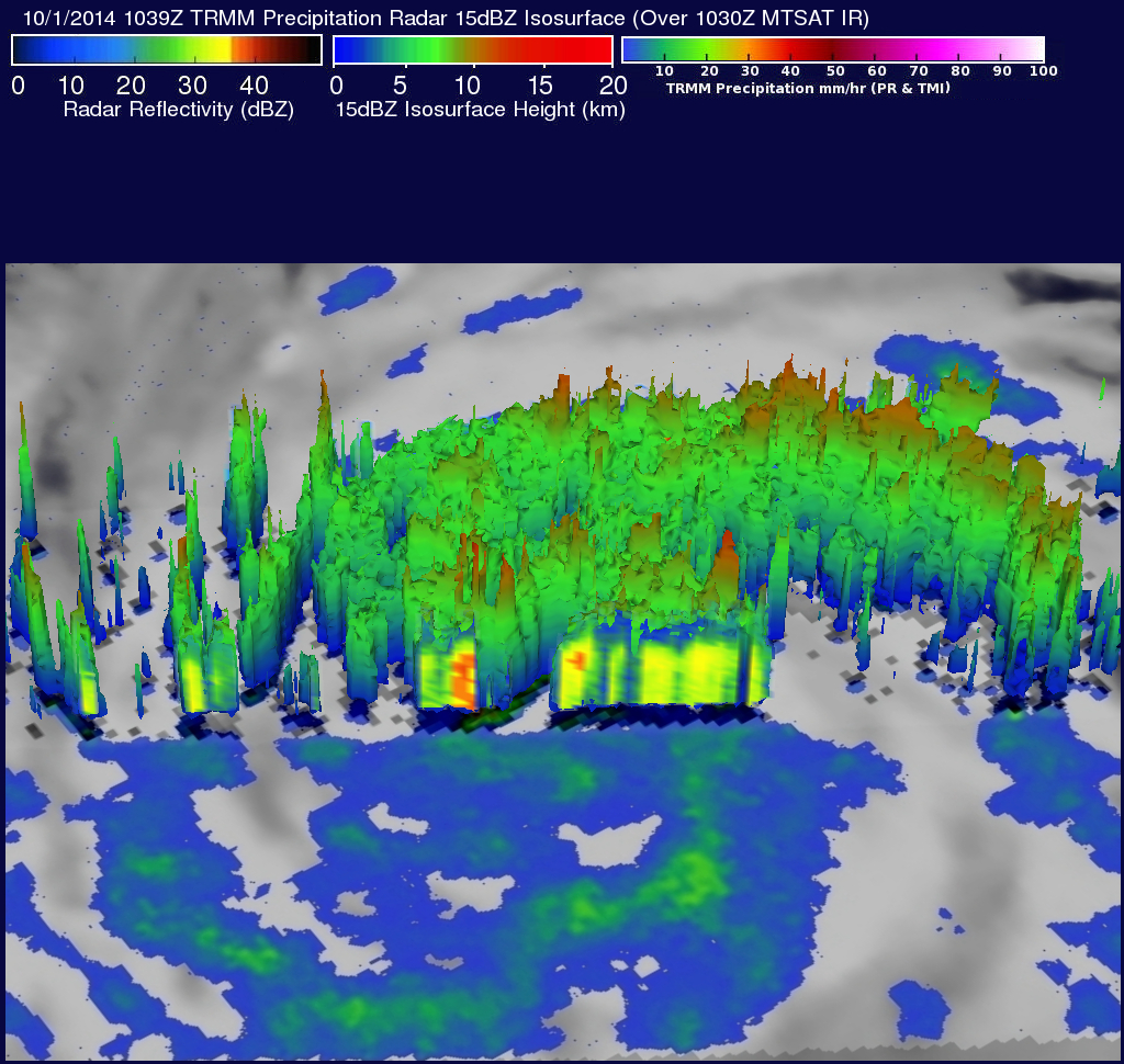
TRMM's Precipitation Radar (PR) radar reflectivity data were used in this 3-D view (from the northeast) to shown the vertical rainfall structure with typhoon Phanfone. TRMM PR data shows a slice through the tropical cyclone's center with some thunderstorms reaching heights of over 12.3 km ( about 7.6 miles).


