
Weaker Typhoon Soulik Heads Towards Taiwan
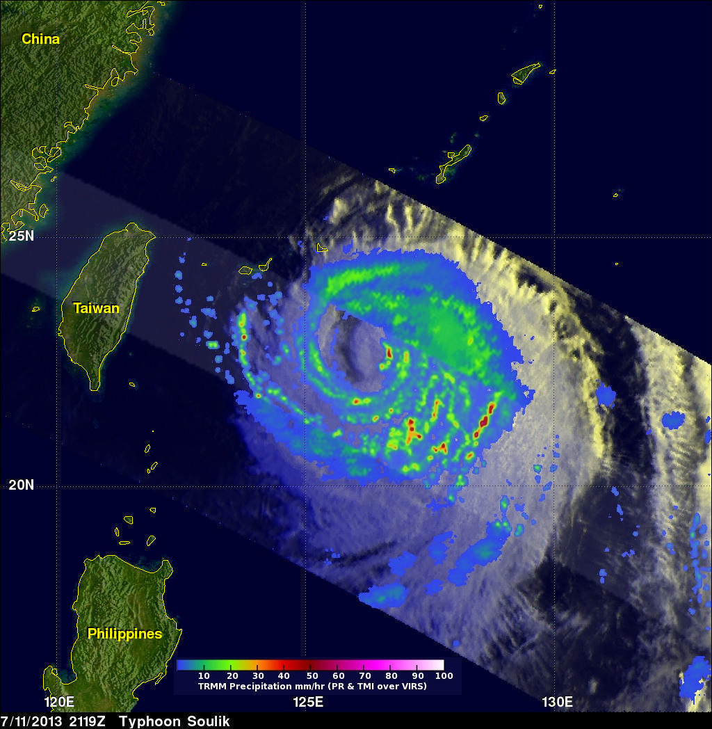
TRMM satellite again flew above weakening typhoon Soulik on July 11, 2013 at 2119 UTC. Data from TRMM's Microwave Imager (TMI) and Precipitation Radar (PR) instruments show that Soulik had weakened considerably. The eye diameter was shown to be much greater than when TRMM passed over super typhoon Soulik about 7 hours earlier.
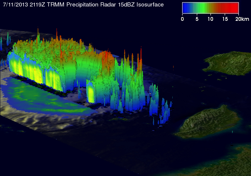
This TRMM Precipitation Radar 3-D view (from the northwest) shows typhoon Soulik east of Taiwan. The structure of Soulik's large eye is clearly shown by this TRMM PR slice through the weakening typhoon. Soulik is predicted by the Joint Typhoon Warning Center (JTWC) to be a still powerful category two typhoon with winds of about 90kts (~104 mph) as it approaches Taiwan tomorrow.
Click here to see a July 11, 2013 at 2119 UTC simulated 3-D (Quicktime) flyby over Soulik using these TRMM PR data.
Click here to see a July 11, 2013 at 2119 UTC simulated 3-D (MPEG) flyby over Soulik using these TRMM PR data.