
IMERG Supports Response for Typhoon Sinlaku
Tuesday, April 28, 2026
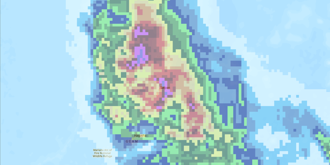
When Typhoon Sinlaku struck the Northern Mariana Islands and Guam, it disabled ground-based weather radars and rain gauges – the very tools designed to track the storm. As part of the coordinated U.S. response to Sinlaku, the NASA Disasters Program shared IMERG satellite-based observations of rainfall, filling a critical data gap and giving responders a clearer view of the storm’s impacts to the islands.
Learn more: