
GPM Supports the IMPACTS Airborne Campaign to Study Snowfall
The Investigation of Microphysics and Precipitation for Atlantic Coast-Threatening Storms (IMPACTS) mission, now in its second year, is flying aircraft into snowstorms in order to improve meteorological models and our ability to use satellite data to predict how much snow will fall and where.
NASA and its partners have several satellites that measure precipitation from space, such as the Global Precipitation Measurement (GPM) mission that observes rain and snow around most of the world every three hours. “But satellites can’t tell us a lot about the particles – the actual snowflakes – and where they form within the clouds,” said Gerry Heymsfield, one of the deputy principal investigators for IMPACTS at Goddard.
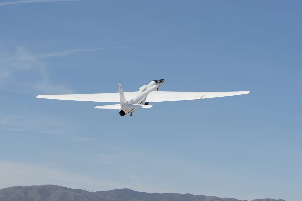
NASA’s ER-2, a high-altitude jet equipped with a suite of science instruments, takes off. Credits: NASA’s Armstrong Flight Research Center
Instead, IMPACTS is flying two aircraft outfitted with scientific instruments. The NASA Armstrong Flight Research Center’s ER-2, a high-altitude jet flying out of the Pope Army Airfield near Fayetteville, North Carolina, will fly at about 65,000 feet to get a top-down view from above the clouds. The instruments aboard the ER-2 are similar to those on satellites but with higher spatial resolution, additional measurement capabilities and more frequent sampling.
Scientists on the ground are also measuring cloud properties from below using ground-based radars and gauges. Researchers from NASA's GPM Ground Validation Program are supporting IMPACTS campaign with ground-based sensors at Wallops Flight Facility and at the University of Connecticut. These include the Precipitation Imaging Package (PIP), which uses high speed cameras to view falling snow and retrieve the size, shape and speed of falling flakes, and the Micro Rain Radar (MRR), a low-power radar that provides important info on the low-level structure and wind characteristics of snow clouds. They are also using a a Parsivel disdrometer that provides info on the size, shape and habit (growth patterns) of precipitation particles, and a Pluvio weighing gauge that provides the mass of liquid water from snowfall. The data collected by IMPACTS will help the team relate properties of the snow particles and their environment to large-scale processes – such as the structure of clouds and precipitation patterns – that can be seen with remote sensing instruments on aircraft and satellites.
The multi-year IMPACTS campaign is the first comprehensive study of snowstorms across the Eastern United States in 30 years. The science team includes researchers from NASA, several universities across the country, the National Center for Atmospheric Research, and NOAA, including partners at the National Weather Service.
Learn more about IMPACTS at nasa.gov: NASA Planes Fly into Snowstorms to Study Snowfall
Visit the IMPACTS project homepage
Access IMPACTS precipitation data
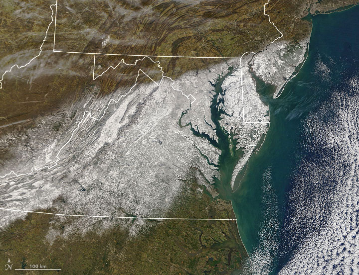
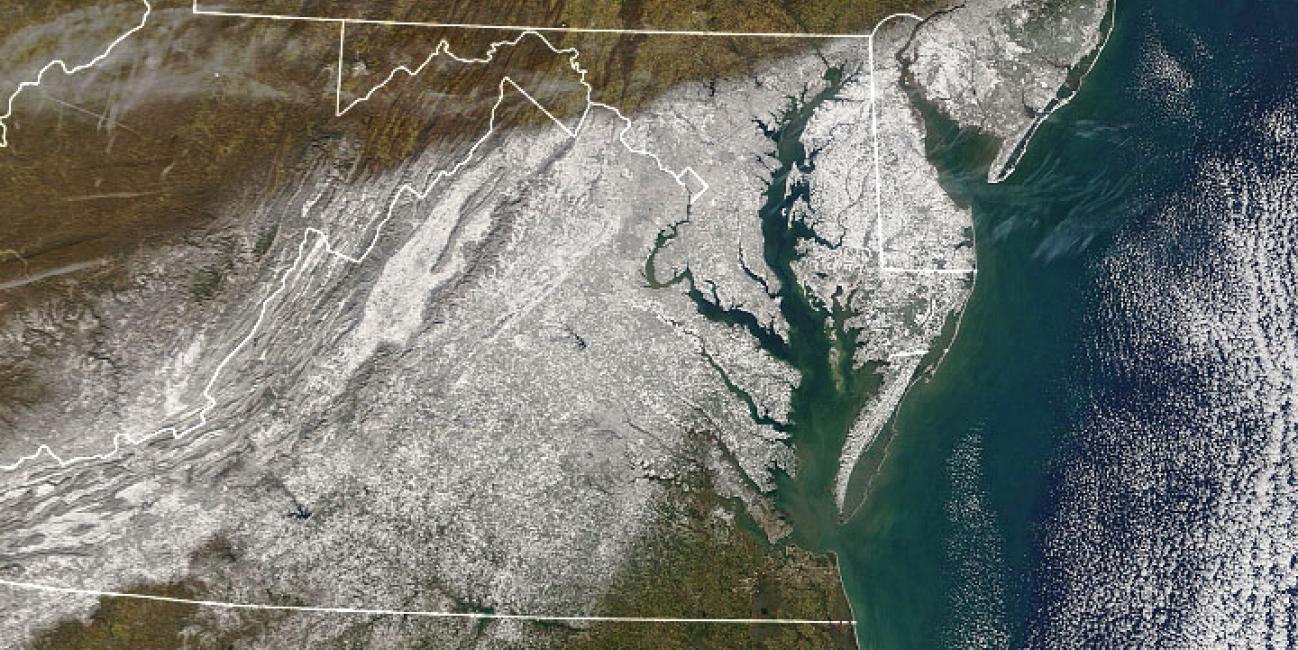
On Jan. 4, 2022, the MODIS instrument aboard NASA’s Terra satellite captured this image of snowfall after a large storm dumped wet, heavy snow across the Mid-Atlantic region of the United States. Some areas accumulated over 14 inches, shutting down businesses, schools, and interstate highways. Credits: NASA