

TMPA Shows El Niño Conditions in the Pacific
An El Niño that began to form last fall has matured and is now fully entrenched across the Pacific. Changes in sea surface temperatures, or SSTs, brought about by an El Niño affect the atmosphere, resulting in distinctive changes in the rainfall pattern across the Pacific Basin. These changes show up as anomalies or deviations in NASA’s analysis of climatological rainfall.
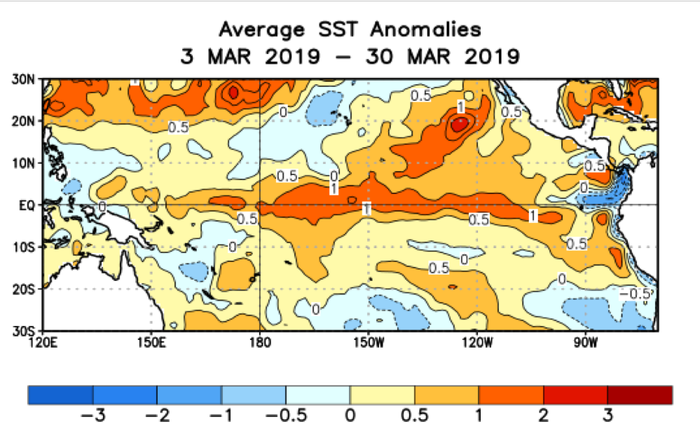 This map shows sea surface temperature (SST) anomalies for the Pacific Basin, shown as degrees Celsius above or below average. Credit: NOAA Climate Prediction Center.
In a typical El Niño, warmer than average SSTs off of the coast of Peru lead to enhanced convection (rising air that condenses and forms clouds and storms) and above average rainfall in the eastern Pacific near to the Equator and lower than average rainfall over the western Pacific.
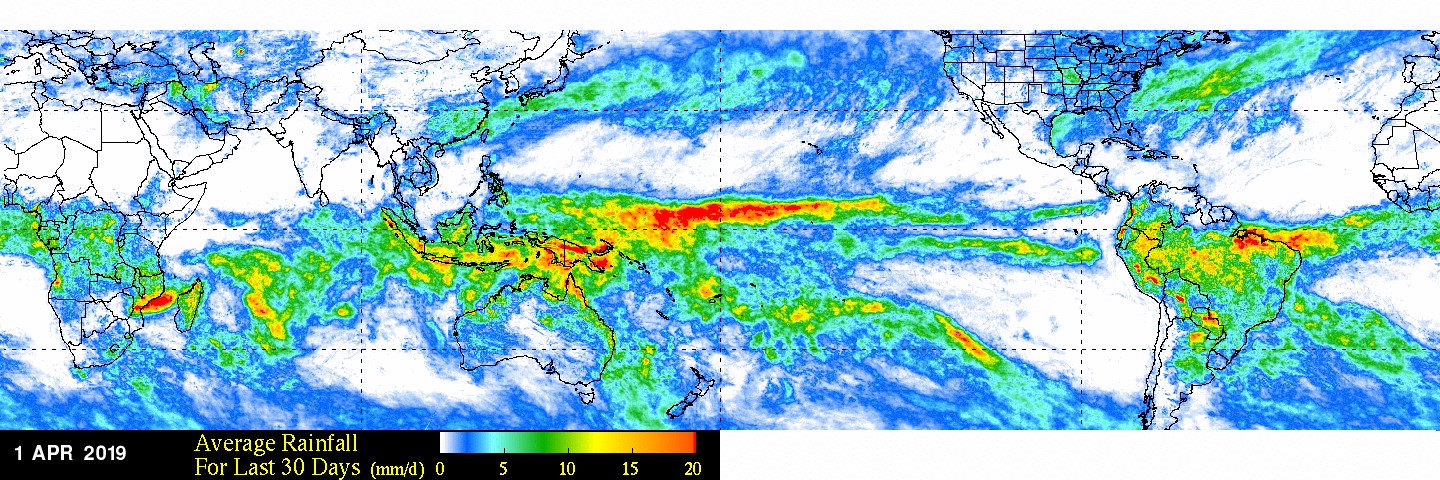 This map shows the average precipitation rate across the globe in millimeters per day for the past 30 days leading up to April 1st, 2019, calculated using the TRMM Multi-satellite Precipitation Analysis (TMPA) product. Credit: NASA GFSC
However, recent estimates of monthly average rainfall and corresponding rainfall anomalies show heavy rain and above-average rainfall located across the Equatorial Central Pacific not the eastern Pacific. This is what is known as El Niño “Modoki” (Japanese for “a similar but different thing”) or a Central Pacific El Niño wherein enhanced SSTs and rainfall occur near the dateline and not near the coast of Peru.
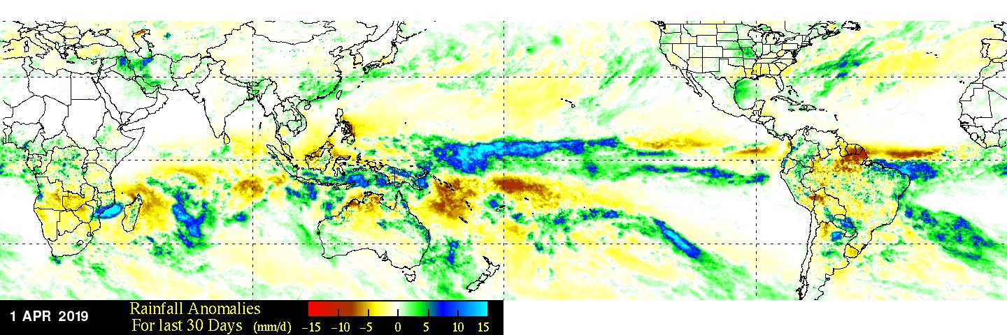 This map shows where precipitation rates were higher or lower than the climatological average, for the past 30 days leading up to April 1st, 2019. Credit: NASA GSFC
The estimates are generated from the legacy TRMM-based TMPA rainfall product at NASA’s Goddard Space Flight Center in Greenbelt, Md. TRMM was the Tropical Rainfall Measuring Mission satellite that the rainfall product was based on and named for, but TRMM has been succeeded by the Global Precipitation Measurement mission or GPM constellation of satellites. TMPA rainfall is the TRMM Multi-satellite recipitation Analysis.
As with a traditional El Niño, the effects from a Central Pacific El Niño can still propagate to the U.S. Also, clearly visible in the NASA-generated monthly average rainfall was an area of heavy rain over the southeast coast of Africa associated with the passage of Cyclone Idai, which devastated the region with torrential flooding.
Story by Steve Lang
NASA’s Goddard Space Flight Center, Greenbelt, Md.