Two Future Typhoons Monitored By GPM
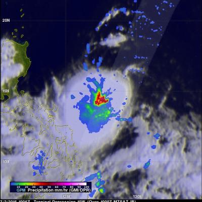
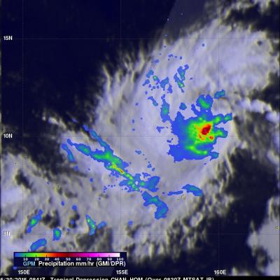
A chain of tropical cyclones has started forming in the western Pacific Ocean. The GPM core observatory satellite saw two of them this morning. Tropical storm Chan-Hom was seen southeast of Guam by GPM on July 2, 1015 at 0834 UTC. Less than two hours later at 1006 UTC GPM passed over intensifying tropical depression 10W that was located east of the Philippines. Both are expected to become more powerful over the next few days. Typhoon Chan-Hom is predicted by the Joint Typhoon Warning Center (JTWC) to pass just northeast of Guam with winds of over 80 kts (92 mph). TD10W is also predicted to be