Halola

Typhoon Halola Threatening Japan

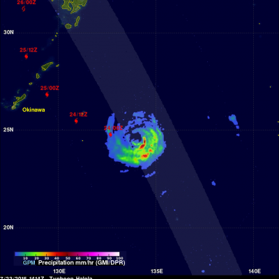
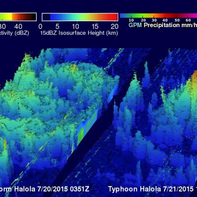
Typhoon Halola is predicted by the Joint Typhoon Warning Center (JTWC) to weaken to tropical storm intensity over the next couple days while passing to the north of Okinawa, Japan. Recent predictions of Halola's track are shown overlaid in red. The GPM core observatory's Microwave Imager (GMI) and Dual-Frequency Precipitation Radar (DPR) measured rainfall as it flew directly over typhoon Halola in the western Pacific Ocean on July 23, 2015 at 1414 UTC. A simulated 3-D flyby around typhoon Halola was made from GPM Radar data (Ku Band). This animation shows that that Halola's eye wall was

GPM Sees Halola Becoming A Typhoon

Satellite technology has the ability to see things we could never imagine, like how hard the rain is falling in storms, and how high cloud tops stretch into the atmosphere. The Global Precipitation Measurement (GPM) core observatory satellite does both of those things and has been providing that information each time it passes over Typhoon Halola in the Northwestern Pacific Ocean. The GPM core observatory is a joint effort between NASA and the Japan Aerospace Exploration Agency. GPM saw Halola when it was strengthening from a tropical storm into a typhoon. GPM flew over Tropical Storm Halola

NASA Sees Heavy Rainfall in Tropical Storm Halola

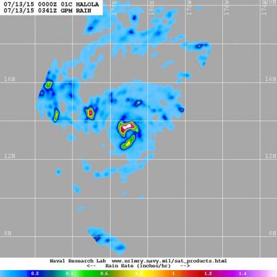
The GPM satellite passed over Tropical Storm Halola in the northwestern Pacific Ocean and found heaviest rainfall occurring north of the center of circulation. Halola formed in the Central Pacific Ocean and moved into the Northwestern Pacific Ocean basin today, July 13. On July 13 at 1500 UTC (11 a.m. EDT) Tropical Storm Halola had maximum sustained winds near 60 knots (69 mph/111.1 kph). It was located near 14.5 North and 177.0 East, about 694 nautical miles (798 miles/1,285 km) east-southeast of Wake Island. Halola has tracked west-northwestward at 11 knots (12.6 mph/20.3 kph). The Global