Marco

IMERG Rainfall Totals from Hurricanes Marco and Laura
The northern Gulf Coast, specifically Louisiana, saw two tropical cyclones make landfall in the same week just days apart. The two systems, however, could not have been more different when they arrived. Despite forming a day later, Marco was the first system to make landfall on the Gulf Coast. Marco originated from a tropical easterly wave that was moving from the central to the western Caribbean. After becoming a tropical depression (TD) on the 20th of August, TD #14 turned northwestward the following day as it approached the coast of Central America and moved into the northwest Caribbean
Hurricane Laura on August 27, 2020
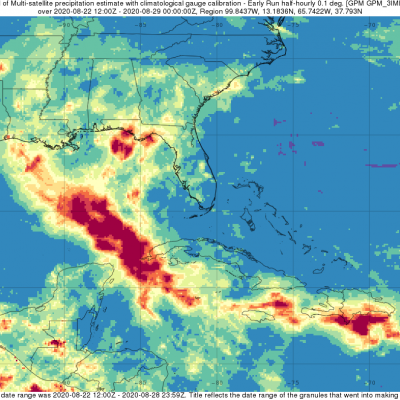
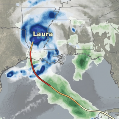
Update on August 28, 2020: During its approach to Louisiana, Hurricane Laura dramatically intensified from Category 2 to 4 (105 mph to 150 mph) between at 1AM and 7PM Central Time (CDT) on August 26, 2020. In the updated movie below, the precipitation falling from Laura is shown through 10:30PM CDT, August 27, as estimated by NASA's IMERG algorithm. To open the animation in a separate window, click here . On August 26, Laura became the first North Atlantic hurricane to reach "major hurricane" status this year, meaning that it reached category 3 on the Saffir-Simpson hurricane-intensity scale