
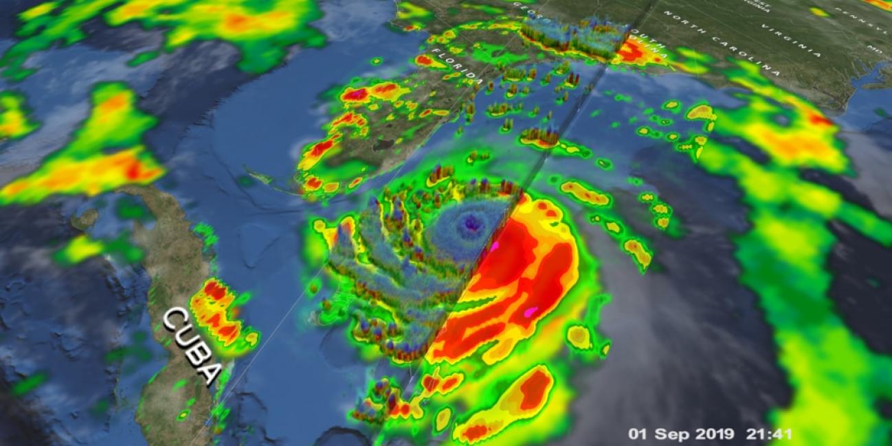
GPM Flies Over Hurricane Dorian
Download in high resolution from the NASA Goddard Scientific Visualization Studio.
The NASA / JAXA Global Precipitation Measurement (GPM) Core Observatory flew over Hurricane Dorian on September 1st (5:22pm ET / 21:22 UTC) as the storm was directly over Abaco Island in The Bahamas. The satellite captured data on rainfall rates within the storm as it flew over using its Dual-frequency Precipitation Radar (DPR) and GPM Microwave Imager (GMI).
In this animation the multi-satellite GPM IMERG product is shown first to illustrate rainfall rates prior to the overpass. When the camera zooms in data from the DPR is shown, revealing the structure and intensity of precipitation within the eye of the storm.
At the time of this overpass Dorian was a category 5 hurricane with maximum sustained winds of 185 mph (295 km/h) and gusts over 200 mph.
Credit: Kel Elkins (NASA Goddard Scientific Visualization Studio)