
GPM Sees Cyclone Amphan Approach India
On May 16, 2020, NASA / JAXA's GPM Core Observatory satellite observed the early stages of Tropical Cyclone Amphan as it tracked north over the Bay of Bengal. The below GPM overpass shows precipitation within Cyclone Amphan a day before it explosively intensified into a category 4-equivalent cyclone. Even at this early stage, Amphan produced heavy rain rates near its center and to its west and southwest.
View fullscreen in STORM Event Viewer
NASA monitored the heavy rain associated with Tropical Cyclone Amphan as it made landfall at 0900 UTC (2:30 PM local time) on May 20, 2020. Landfall occurred near the India-Bangladesh border along the northern edge of the Bay of Bengal. At the time of the most recent satellite observation used to generate this image (0900 UTC, May 20), heavy rain had started falling along the coast but large accumulations had not yet occurred over land. So far the largest rainfall accumulation from Amphan has fallen over the Bay of Bengal on May 18 while Amphan was at category 5 on the Saffir-Simpson scale.

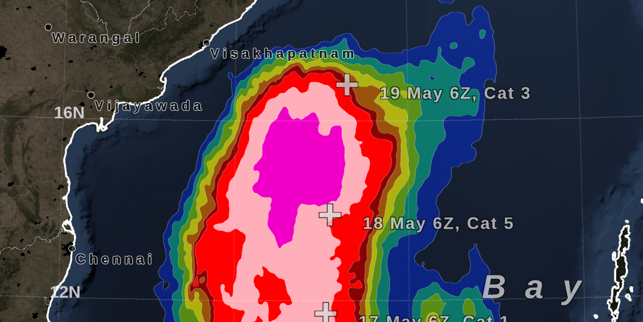
GPM IMERG estimated rainfall totals from Cyclone Amphan from May 16 - 19, 2020. Credit: Owen Kelley (NASA GSFC)
To estimate storm-total rain accumulation in near real-time NASA's IMERG algorithm combines information from multiple satellite observations. Foremost are near-continuous infrared satellite observations of cloud-top temperature, microwave observations by polar-orbiting satellites that collect ribbons of data as they zip across the Earth's surface, and model analysis of wind that is used to morph satellite data backwards and forwards in time.
Visualization and text by Owen Kelley (NASA GSFC)