
GPM Sees Cyclone Harold in the South Pacific
Video credit: Greg Shirah, Kel Elkins, Alex Kekesi (NASA Goddard Scientific Visualization Studio). For more information or to download this public domain video, go to: https://svs.gsfc.nasa.gov/4812#29226
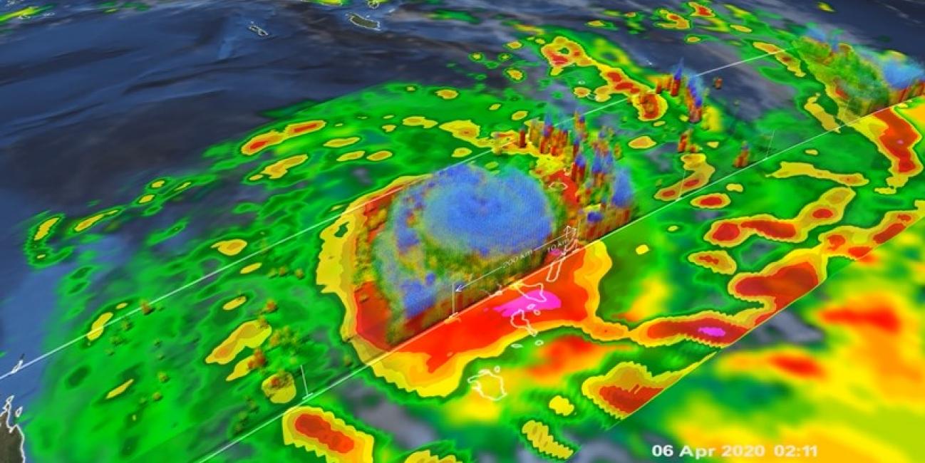
A Category 4 cyclone, the most powerful yet of 2020, made landfall on the South Pacific nation of Vanuatu on Monday, not long before this GPM overpass from April 6th, 2020 at 1:41 UTC. Tropical Cyclone Harold developed from a low pressure system that was observed to the east of Papua New Guinea last week, and has tracked to the southeast, where it has already caused flooding and loss of life in the Solomon Islands. Early reports from Vanuatu indicate heavy flooding and property damage.
Video Credit: Jason West (KBR / NASA GSFC)
Download video (right-click -> Save As)
This animation shows the heavy precipitation associated with Tropical Cyclone Harold as it progressed from the Solomon Islands (upper left) on April 2, 2020, explosively intensified on April 3, reached Vanuatu (center) as a Category 4 storm on April 5 before briefly attaining Category 5 status on April 6 and passing just south of Fiji (center right) on April 7 as a Category 4 storm. Periodically, Harold's core region produced precipitation rates in excess of 30 millimeters per hour (mm/h), which is equivalent to a 7 inch deep rain accumulation if the core region were to remain over a given location for 6 hours. The precipitation estimates in this animation come from the IMERG multi-satellite algorithm developed by NASA and run in near realtime.
Interactive Visualziation of the April 6th, 2020 GPM Overpass
Interactive Visualization Credit: Jason West (KBR / NASA GFSFC)