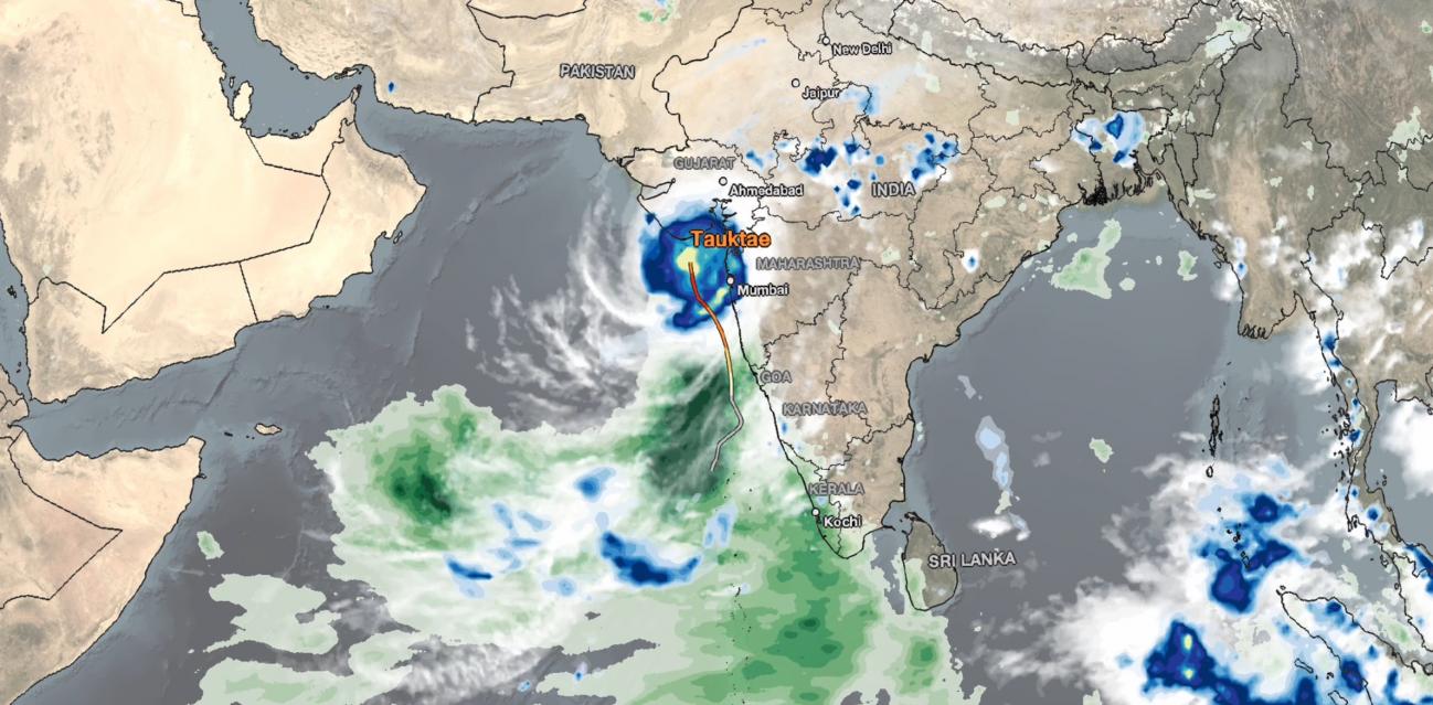
IMERG Observes Rainfall from Tropical Cyclone Tauktae in India
NASA combined data from multiple satellites in the GPM Constellation to estimate precipitation rates and totals from Tropical Cyclone Tauktae in May 2021. The below animation shows precipitation rates (blue/yellow shading) and accumulations (green shading) at half-hourly intervals from May 12-19, 2021, derived from NASA's IMERG algorithm. Underneath the precipitation data, cloud cover is shown in shades of white/gray based on geosynchronous satellite infrared observations. On top of the precipitation data, the cyclone's approximate track is displayed based on estimates from the Joint Typhoon Warning Center (JTWC).
Download video (right-click -> Save As)
In mid-May 2021, the tropical Indian Ocean was covered by large areas of cloudiness and precipitation consistent with an active Madden-Julian Oscillation (MJO). An active phase of the MJO occurs several times each year, marked by 20-90-day alternating wet/dry conditions. The MJO event was accompanied by a westerly wind burst just north of the equator, which contributed to the formation of a tropical cyclone in the Arabian Sea. The cyclone, named 'Tauktae' by the Indian Meteorological Department, tracked northward over very warm water, intensifying to its peak as a Category 4-equivalent cyclone on May 17 as it passed Mumbai. It made landfall over the Indian state of Gujarat later on May 17 as a Category 3-equivalent cyclone before weakening as it continued inland. Over the approximately 7-day period of the animation, the greatest amount of precipitation fell near Tauktae's track over the Arabian Sea. Accumulations over land were smaller, but nearly the entire western coastline of India was affected by Tauktae's rainfall, with IMERG estimating some of the highest precipitation accumulations of over 250 millimeters (10 inches) in the area around Mumbai, consistent with 7-day measurements by the Indian Meteorological Department.
Credits:
Animation and story by Jason West (NASA GSFC)

