India

2021 average daily rainfall June, July August.
The Indian summer monsoon, also known as the southwest monsoon, falls within the South Asian monsoon and is the strongest and perhaps best-known of the world’s monsoons. During summer months when the Asian landmass heats up, warm, moist air flows northward from the Indian Ocean towards the Himalayas, bringing abundant showers and thundershowers to India. The summer monsoon is a regular event that occurs every year and is responsible for roughly 80% of India’s annual rainfall. The summer monsoon typically starts in early June, peaks in July and August and winds down during September and early
IMERG Rainfall Totals from Cyclone Tauktae
NASA combined data from multiple satellites in the GPM Constellation to estimate precipitation rates and totals from Tropical Cyclone Tauktae in May 2021. The below animation shows precipitation rates (blue/yellow shading) and accumulations (green shading) at half-hourly intervals from May 12-19, 2021, derived from NASA's IMERG algorithm. Underneath the precipitation data, cloud cover is shown in shades of white/gray based on geosynchronous satellite infrared observations. On top of the precipitation data, the cyclone's approximate track is displayed based on estimates from the Joint Typhoon

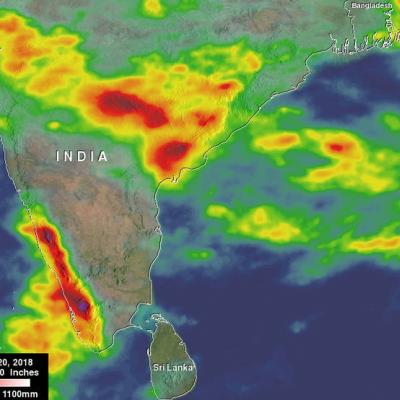
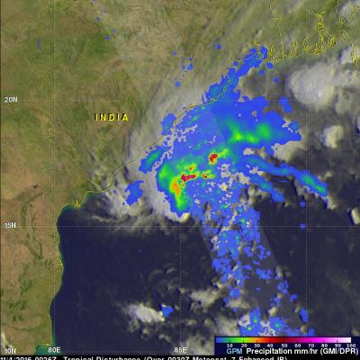
Tropical Cyclone Gaja's Rainfall Measured With IMERG

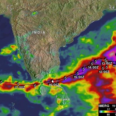
Tropical cyclone Gaja recently caused the deaths of at least 33 people in the southern India state of Tamil Nadu. Gaja's high wind and heavy rains caused landslides and building collapses. Gaja's maximum sustained winds had reached about 75kts (86 mph) when it hit southern India on Friday November 16, 2018. This meant that Gaja was the equivalent of a category one on the Saffir-Simpson hurricane wind scale. Today another tropical low is also moving over southern India and is expected to produce more heavy rainfall in the same area. NASA's Integrated Multi-satellitE Retrievals for GPM (IMERG)

GPM Captures Monsoon Rains Bringing Flooding to India

The summer monsoon is a regular feature this time of year in India, and it can bring heavy rains to the region. However, periodically areas of low pressure can form within the general monsoon trough and bring even more rain. Although the extreme Himalayan topography located to the north is much more well-known, another contributing factor to the heavy rains along the southwest coast of India is the Western Ghats. Though much smaller than the Himalayas, this mountain range runs parallel to the West Coast of India with many peaks over 2,000 meters (~6,500 feet). As a result, the Western Ghats

India's Deadly Monsoon Rainfall Measured With GPM IMERG

India's southwest monsoon (summer rainy season) normally occurs between June and September. This year's monsoon has been assessed as average but India's Meteorological Department statistics show that daily mean rainfall for the country has recently been above normal. At least 15 people were killed by floods and landslides in India on Wednesday July 11, 2018. So far this year, close to 200 deaths may have resulted from India's heavy monsoon rainfall. These estimates of rainfall accumulation were constructed using data from NASA's Integrated Multi-satellitE Retrievals for GPM (IMERG). Algorithms

GPM Sees Ockhi's Rain Reaching India's Western Coast

NASA's GPM Core Observatory satellite passed over western India on December 5, 2017 at 0521 UTC. GPM's Microwave Imager (GMI) and Dual-Frequency Precipitation Radar (DPR) instruments showed precipitation from dissipating tropical cyclone OCKHI reaching India's western coast. GPM's radar (DPR Ku band) indicated that rain was falling at a rate of over 101.6 mm (4 inches) per hour in a few storms near India's coast. OCKHI's low level center of circulation, shown with a red tropical cyclone symbol, was located well to the southwest of the storms that were moving onto India's western coast. This 3

IMERG Shows Heavy Rainfall From Southwest India To Northeast India

In the past couple weeks rainfall has had a significant impact on Sri Lanka, southwestern India, Bangladesh and eastern India. Monsoon rainfall caused widespread flooding, devastating mudslides and displacements of many thousands of people in Sri Lanka. Over 200 people's deaths have now been attributed to this disaster. Then cyclone Mora formed in the Bay Of Bengal on May 27, 2017. Heavy rain from Mora and it's remnants moved over southeastern Bangladesh and northeastern India. Monsoon rainfall also started to move into southern India. This rainfall analysis was derived from NASA's Integrated

Cyclone Mora Examined By GPM

The GPM core observatory satellite passed over cyclone Mora on May 30, 2017 at 1121 UTC. Mora had passed into southeastern Bangladesh less than six hours earlier. Maximum sustained winds within Mora were estimated to be about 55 kts (63 mph) when GPM passed above. Data received by GPM's Microwave Imager (GMI) and Dual-Frequency Precipitation Radar (DPR) instruments revealed the location and intensity of rainfall around the dissipating cyclone. GPM's radar swath, shown in lighter shades, covered the area west of the dissipating cyclone's center. GPM's DPR found that rain was still falling at a

Tropical Disturbance Threatens India and Bangladesh

A tropical disturbance that recently formed in the Bay Of Bengal may cause heavy rainfall in the next few days along coastal India's eastern state of Odisha and southern Bangladesh. The low is predicted to move northeastward over the warm waters of the Bay Of Bengal but according to the Joint Typhoon Warning Center (JTWC) has only a medium chance of developing into a tropical cyclone. High vertical wind shear is forecast to keep the tropical disturbance from intensifying. The GPM core observatory flew above the low on November 4, 2016 at 0026 UTC. GPM saw that the low contained some strong

Monsoons: Wet, Dry, Repeat

Submitted by JacobAdmin on Thu, 06/23/2016
Video Embed

The monsoon is a seasonal rain and wind pattern that occurs over South Asia (among other places). Through NASA satellites and models we can see the monsoon patterns like never before. 

Monsoon rains provide important reservoirs of water that sustain human activities like agriculture and supports the natural environment through replenishment of aquifers. However, too much rainfall routinely causes disasters in the region, including flooding of the major rivers and landslides in areas of steep topography.