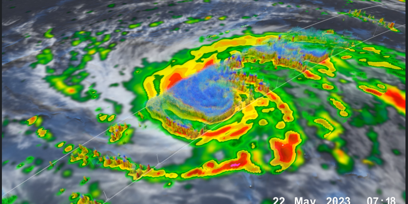
GPM Captures Typhoon Mawar
Driven by powerful winds and intense rainfall, Typhoon Mawar emerged as a rapidly intensifying storm in the western Pacific Ocean. Originating from a tropical disturbance, the typhoon swiftly developed into a significant weather system, eventually making landfall on the U.S. territory of Guam on May 25, 2023, as a Category 4 typhoon. After hitting Guam, it further intensified into a Category 5 typhoon, making it one of the most powerful storms on record in the month of May.
Download this video from the NASA Goddard Scientific Visualization Studio
The combination of NASA’s IMERG precipitation product and the GPM Core Observatory satellite with its array of active and passive sensors is ideal for monitoring and studying tropical cyclones. The above animation shows Mawar on it's approach to Guam on May 22, 2023, shortly after it's eyewall had formed. At this stage the storm had sustained wind speeds of up to 110 knots (127 mph) making it a strong category 3 storm. GPM's DPR 3D volumetric sensor clearly shows hot towers near the eye of the storm indicating future intensification.

