ICE-POP: Ground Validation at the Olympics
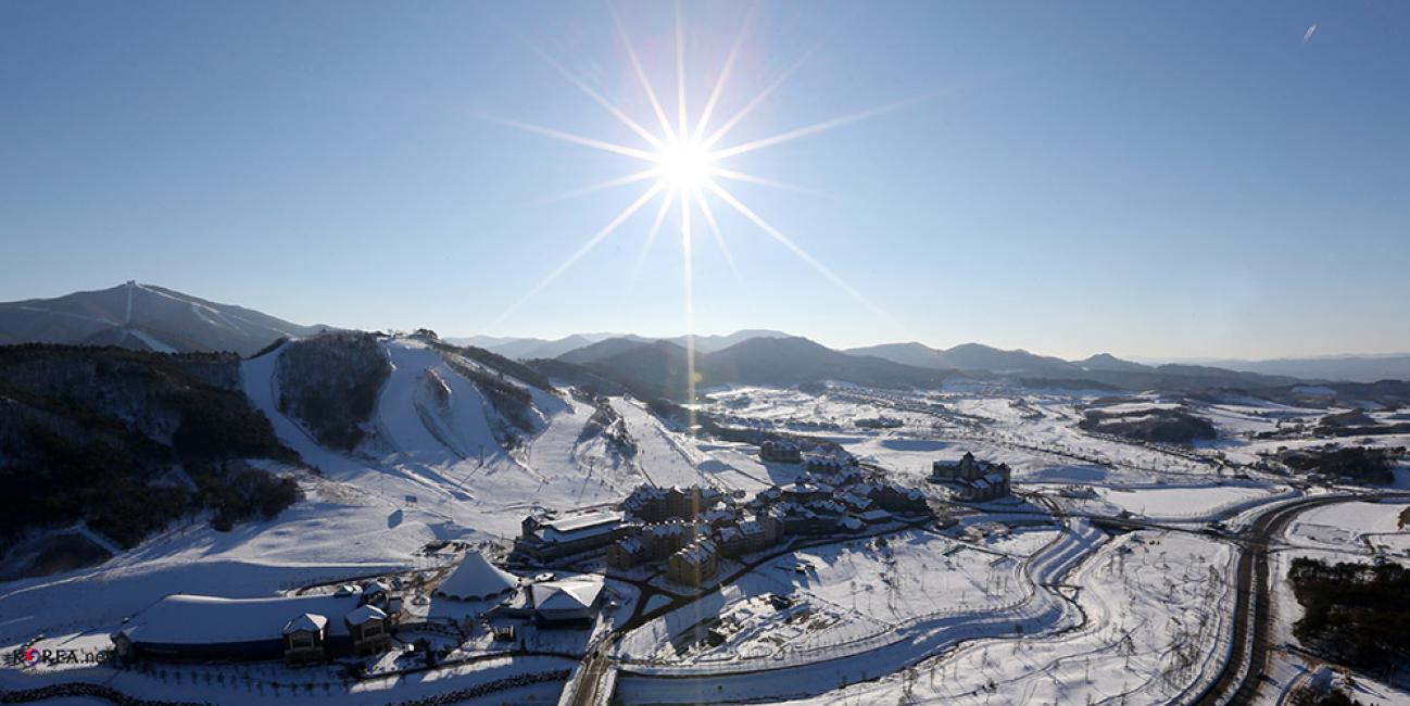
NASA engineer Manuel Vega can see one of the Olympic ski jump towers from the rooftop of the South Korean weather office where he is stationed. Vega is not watching skiers take flight, preparing for the 2018 PyeongChang Winter Olympics and Paralympic games. Instead, he's inspecting the SUV-sized radar beside him. The instrument is one of 11 NASA instruments specially transported to the Olympics to measure the quantity and type of snow falling on the slopes, tracks and halfpipes.
Download this video in high resolution from the NASA Goddard Scientific Visualization Studio.
NASA will make these observations as one of 20 agencies from eleven countries in the Republic of Korea as participants in a project called the International Collaborative Experiments for PyeongChang 2018 Olympic and Paralympic Winter Games, or ICE-POP. Led by Korea Meteorological Administration, the international team will make snow measurements from the start of the Olympics on Feb. 9 through the end of the Paralympics on March 18.
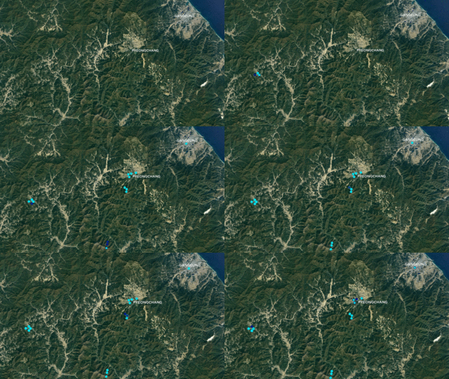
Vega and the international team is studying how well researchers can measure snow from the ground and space and provide better data for snowstorm predictions. The NASA team, along with U.S. colleagues at Colorado State University, the National Center for Atmospheric Research, and National Oceanic and Atmospheric Administration (NOAA), will use a collection of ground instruments, satellite data, and weather models to deliver detailed reports of current snow conditions and will test experimental forecasts models. NASA's observations and snow forecasts will be made at 16 different points near Olympic event venues and then relayed to Olympic officials to help them account for approaching weather.
 NASA's observations and experimental, real-time snow forecasts will be made at 16 different points near Olympic event venues every six hours and then relayed to Olympic officials. The NASA-Unified Weather Research Forecast Model (NU-WRF) is one of five real-time research forecast models being used in ICE-POP.
Credits: Joy Ng, NASA Goddard / NASA Marshall
"The Olympics provide a means to test some of our observation methods and help develop prediction models in a real-world applied environment and enable our observations to be used by the forecasters and Olympic planning folks as well," Vega said.
At times, the weather in this part of northeast South Korea is not much different from Greenbelt, Maryland, where Vega works at NASA's Goddard Space Flight Center. But South Korea has much colder extremes. The area is higher in elevation, windier because of the mountains, and also has very diverse terrain. In a matter of hours, Vega could travel from a coastal beach area to snowy mountains – and so could a snowstorm.
"We are interested in South Korea because we can improve our understanding of the physics of snow in mountainous areas to help improve the accuracy of our observations and models," said Walt Petersen, research physical scientist at NASA's Marshall Space Flight Center, Huntsville, Alabama. Petersen is in charge of coordinating the NASA ground instruments and science in the PyeongChang area with the ICE-POP international science community.
Petersen says a big snow producer for the PyeongChang area is a system he calls a "backdoor cold front." Big domes of cold air travel over the Sea of Japan picking up moisture and energy and then hit South Korea on the northeast side. The terrain on the east side of the Korean peninsula changes dramatically from the coastal area to the mountains. With such a steep change in terrain, air flow can change rapidly and spur big snow events near PyeongChang – and that's what the team is hoping for in order to test how well they can observe and predict snowstorms.
Vega and the international team is studying how well researchers can measure snow from the ground and space and provide better data for snowstorm predictions. The NASA team, along with U.S. colleagues at Colorado State University, the National Center for Atmospheric Research, and National Oceanic and Atmospheric Administration (NOAA), will use a collection of ground instruments, satellite data, and weather models to deliver detailed reports of current snow conditions and will test experimental forecasts models. NASA's observations and snow forecasts will be made at 16 different points near Olympic event venues and then relayed to Olympic officials to help them account for approaching weather.
Tracking Snow in Tricky Terrain
South Korea's diverse terrain makes this project an exciting, albeit challenging, endeavor for scientists to study snow events. Ground instruments provide accurate snow observations in easily accessible surfaces, but not on uneven mountainous terrain. A satellite in space has the ideal vantage point, but space measurements are difficult because snow varies in size, shape and water content. Those variables mean the snowflakes won't fall at the same speed, making it hard to estimate the rates of snowfall. Snowflakes also have angles and planar "surfaces" that make it difficult for satellite radars to read.
The solution is to gather data from space and the ground and compare the measurements. NASA will track snowstorms from space using the Global Precipitation Measurement mission, or GPM. The GPM Core Observatory, a satellite designed to estimate rainfall rates and detect falling snow from space, is a joint mission between NASA and the Japan Aerospace Exploration Agency, and coordinates with twelve other U.S. and international satellites to provide global maps of precipitation every 30 minutes.
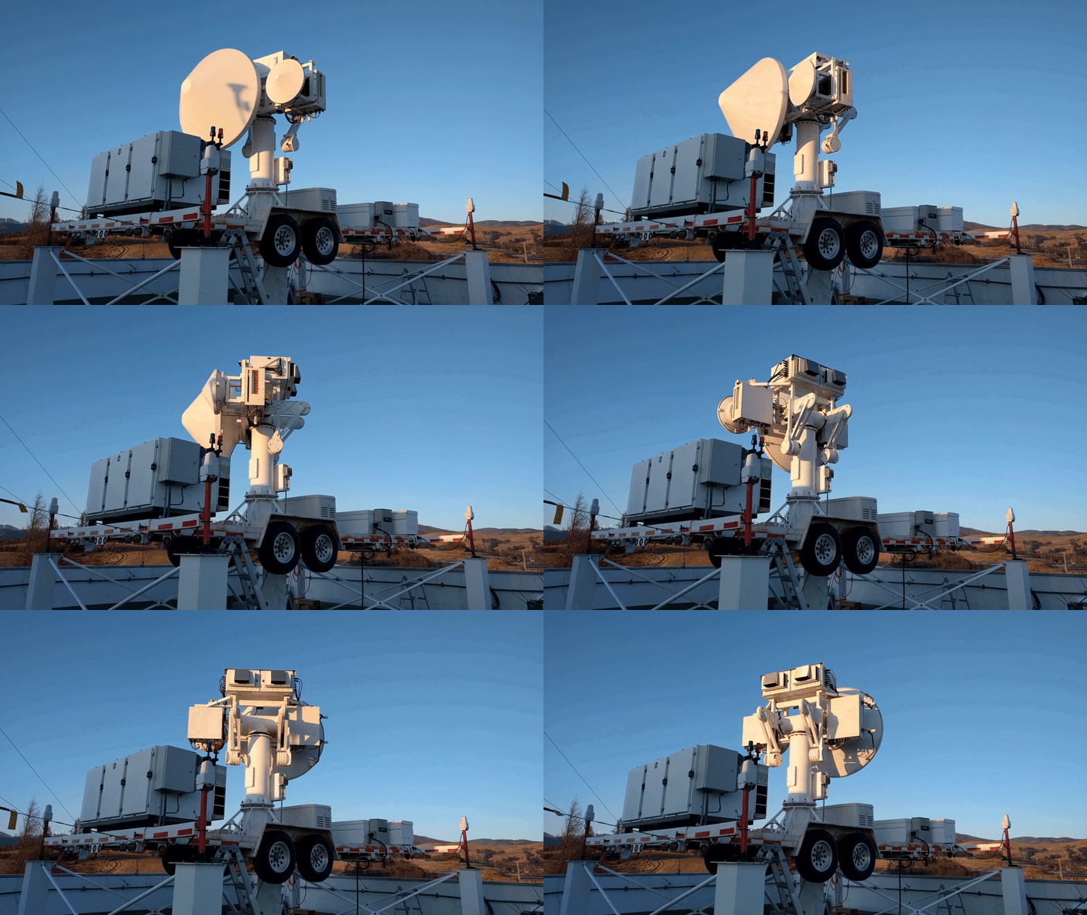
 NASA deployed the Dual-frequency, Dual-polarized, Doppler Radar (D3R) system that measures the quantity and types of falling snow. The NASA instrument uses a team of Colorado State University engineers to support radar development, maintenance, and operations and will operate the radar during the Olympic and Paralympic games. The animation here shows the D3R rotating to change its viewpoint (motion is not in real time).
Credits: NASA/Colorado State University
The team will complement the space data with 11 NASA instruments observing weather from the ground in PyeongChang. These instruments are contributing to a larger international pool of measurements taken by instruments from the other ICE-POP participants: a total of 70 instruments deployed at the Olympics. A few of the NASA instruments are snow imagers that use high speed cameras and advanced software to image every single snowflake falling in its viewing area, useful for counting the snowflakes and determining how much water is falling at that moment.
Another ground instrument is NASA’s Dual-frequency, Dual-polarized, Doppler Radar (D3R) system that was lifted by a crane to the roof of DaeGwallyeong Regional Weather Office to measure the quantity and types of falling snow, such as sleet or light and fluffy snow. The radar operates at very similar wavelengths to those used onboard the GPM Core Observatory to provide similar snow observations but from a different vantage point.
Improving Weather Forecast Models
The data will help inform Olympic officials about the current weather conditions, and will also be incorporated into the second leg of NASA's research: improving weather forecast models. NASA's Short-term Prediction Research and Transition Center (SPoRT) is teaming up with NASA Goddard to use an advanced NASA weather prediction model to provide weather forecasts in six-hour intervals over specific points on the Olympic grounds.
NASA SPoRT, which regularly works with the U.S. National Weather Service at NOAA, specifically designed the ICE-POP model with two important improvements. First, the model can better paint a picture of what the cloud is made of, and can provide specific details on whether the cloud is producing rain or snow.
In addition, the ICE-POP includes satellite data of the sea surface temperature surrounding the Korean peninsula from the NASA satellites Terra and Aqua and the NASA/NOAA/Department of Defense Suomi-National Polar Orbiting Partnership satellite, respectively. Sea surface temperature data show scientists how much energy is available and how much moisture could be evaporated into the atmosphere and precipitated out as snow.
"This model includes a complex representation of clouds in atmospheric models to better characterize rain, ice, and snow content in clouds. It also includes one of the highest resolution sea surface temperature products available in real time," said Brad Zavodsky, the project manager for SPoRT at Marshall. "We're excited to see how well this high-resolution model will perform."
NASA SPoRT uses this information to provide Olympic officials experimental, real-time forecasts every six hours using the NASA Unified Weather Research Forecast model (NU-WRF) based at Goddard. The SPoRT team will be providing four forecasts per day to the Korean Meteorological Administration, who will look at this model in conjunction with all the real-time forecast models in the ICE-POP campaign before relaying information to Olympic officials. The NU-WRF is one of five real-time forecast models running in the ICE-POP campaign.
"When you run these models together from the different agencies, you can see how one model behaves versus another one. You learn a great deal about your abilities to predict in a forecast model and how to improve it," Zavodsky said.
To improve the models, scientists will simultaneously run the NU-WRF model at Goddard's Mesoscale Processes Laboratory and examine how adjusting certain parameters in the model change the output, especially to match up with observations made from ground and space instruments.
“If we get an improved model, it opens the possibility of using the model to help improve satellite-based methods for estimating snowfall, and more generally, improves our understanding of clouds, climate, and the water and energy cycles," Petersen said.
In order to build a better model, Petersen's dream scenario at Pyeongchang is for the GPM mission and ground instruments to simultaneously obtain a good view of a few snowstorms. Then they will have enough information to compare different forecast models.
He hopes for what a lot of Olympic athletes want in PyeongChang: precipitation and perfection.

