Andrea brings Heavy Rains to Cuba and parts of the US East Coast
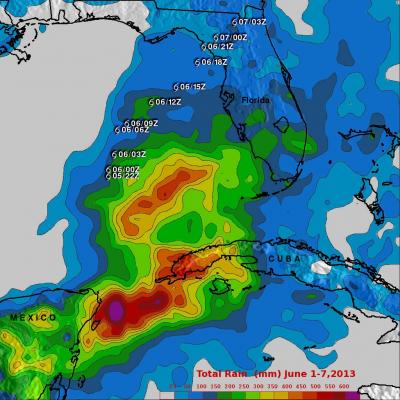
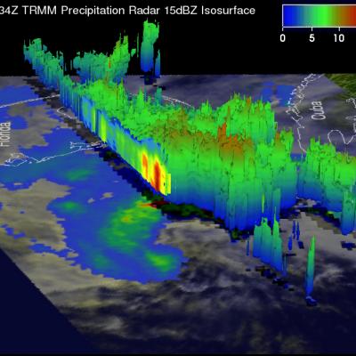
Tropical Storm Andrea formed on the late afternoon of June 5th, 2013 from a trough of low pressure that had persisted for several days over the southeast Gulf of Mexico. This trough extended out over the Gulf from the Yucatan Peninsula and provided the focus for the development of showers and thunderstorms in the region, eventually leading to the formation of Tropical Storm Andrea. With its suite of passive microwave and active radar sensors, TRMM is ideally suited to measure rainfall from space. For increased coverage, TRMM is used to calibrate rainfall estimates from other additional