applications

Faces of GPM: Dr. Dalia Kirschbaum, GPM Applications Scientist

Submitted by JacobAdmin on Fri, 12/27/2013
Video Embed

Dr. Kirschbaum discusses her role with GPM, how she became a scientist, and how remotely sensed satellite data can be used to study and evaluate natural hazards such as landslides.

This video is the first in a series called "Faces of GPM", which will interview several GPM team members to learn what it is like to be a NASA scientist or engineer.


Video Text:

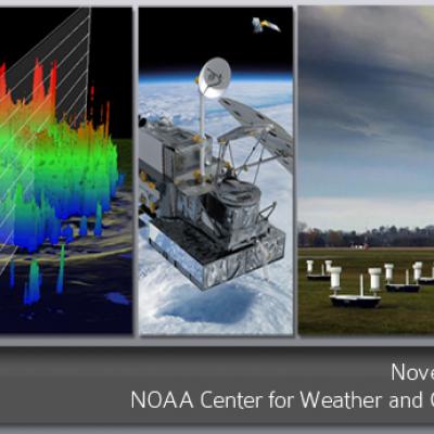
2013 GPM Applications Workshop, November 13th-14, NOAA Center for Climate Predic
This page will redirect you to the 2013 GPM Applications Workshop info page. If you are not redirected, please click here .
NASA satellites used to predict zebra migrations
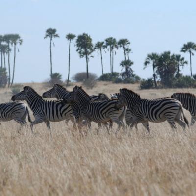
Of stars and stripes: NASA satellites used to predict zebra migrations One of the world's longest migrations of zebras occurs in the African nation of Botswana, but predicting when and where zebras will move has not been possible until now. Using NASA rain and vegetation data, researchers can track when and where arid lands begin to green, and for the first time anticipate if zebras will make the trek or, if the animals find poor conditions en route, understand why they will turn back. Covering an area of approximately 8,500 square miles (22,000 square kilometers), Botswana’s Okavango Delta is...

NASA Satellites Track Zebra Crossing

Submitted by JacobAdmin on Fri, 08/16/2013
Video Embed
Botswana's Okavango Delta and the Makgadikgadi Salt Pans are two ends of a 360-mile round trip zebra migration, the second longest on Earth. In this animation, shades of red show dry areas, green represents vegetation, and the dots show GPS tracked zebras. The zebras begin at the Okavango Delta in late September. After the dry Southern hemisphere winter, November rains signal it is time to begin their two-week journey to the Salt Pans.
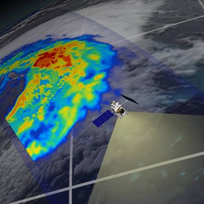
GPM flying over Earth with a data swath visualized.
Date: November 12-13th Location: NOAA Center for Weather and Climate Prediction University of Maryland M Square Research Park College Park, MD 20740 Info: The Global Precipitation Measurement (GPM) and Tropical Rainfall Measuring Mission (TRMM) will hold its first Applications Workshop on November 12-13th, 2013 at the NOAA Center for Weather and Climate Prediction in College Park Maryland. This two day workshop will explore topics of weather forecasting, water resources, agricultural modeling, food security, hydrological modeling, disaster response, ecological forecasting and public health...

GPM: Too Much, Too Little

Submitted by JacobAdmin on Fri, 06/07/2013
Video Embed

Researchers need accurate and timely rainfall information to better understand and model where and when severe floods, frequent landslides and devastating droughts may occur. GPM’s global rainfall data will help to better prepare and respond to a wide range of natural disasters.

Video Text: 

Dalia: GPM will help us to understand precipitation extremes. And this is everything from too much rainfall, such as flooding in India or Southeast Asia, to too little rainfall such as drought in the U.S. Southwest.

University of Maryland hosts the 2nd NOAA User Workshop on GPM JacobAdmin Wed, 11/30/2011
A three day meeting, co-sponsored by NESDIS/STAR and NWS/OHD, is being held at the Earth System Science Interdisciplinary Center (ESSIC) at the University of Maryland from November 29th through December 1st. This meeting follows up on the highly successful first workshop from August 2010 and focuses on user applications of GPM-era data and products. The meeting attendees, including government researchers, academics, and representatives from commercial industry, will hear presentations from NOAA and NASA representatives as well as other end users. The meeting is organized around the five high