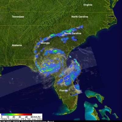
Tropical Storm Beryl Brings Some Much Needed Drought Relief to Southeast US
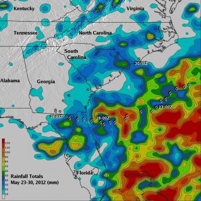
Tropical Storm Beryl was actually a welcome sight in parts of the Southeast. Tropical cyclones are not always bad news. Sometimes they can be quite beneficial, especially when it comes to relieving drought conditions. Tropical Storm Beryl made landfall just after midnight (local time) on the night of 27 May 2012 near Jacksonville Beach, Florida as a strong tropical storm with sustained winds of 70 mph, making it the strongest tropical cyclone to make landfall in the US before the official June 1st start of the Atlantic hurricane season. Prior to the arrival of Beryl, many parts of the