Cape Verde

GPM Satellite Sees Tropical Storm Irma Forming Near Cape Verde Islands

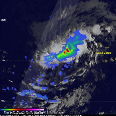
The National Hurricane Center (NHC) upgraded a low pressure area in the far eastern Atlantic Ocean to tropical storm Irma on August 30, 2017 at 11:00 AM AST (1500 UTC). Tropical cyclones that form in that part of the Atlantic Ocean are often the largest and most powerful hurricanes of the season. Hurricanes Ivan (2004), Isabel (2003), Hugo (1989) and Allen (1980) are examples of past powerful hurricanes that formed near the Cape Verde islands. The GPM core observatory satellite flew above forming tropical storm Irma on August 30, 2017 at 1:56 AM EDT (0556 UTC). This new tropical cyclone was

GPM Sees Fred Forming In Cape Verdes

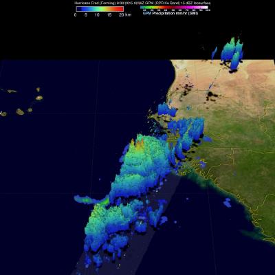
Fred became the first Cape Verdes hurricane of the 2015 Atlantic season when it was upgraded from a tropical storm on August 31, 2015 at 0600 UTC (2 AM AST). The GPM core observatory satellite flew over on August 30, 2015 at 0236 UTC when Fred was forming from a tropical wave that moved off the African coast. Rainfall was measured by GPM's Dual-Frequency Precipitation Radar (DPR) at the extreme rate of close to 128 mm (5.0 inches) per hour. Rainfall in towering convective thunderstorms at Fred’s center of circulation were providing the energy necessary for intensification into a hurricane

Tropical Depression Nine Forms Near Cape Verde Islands

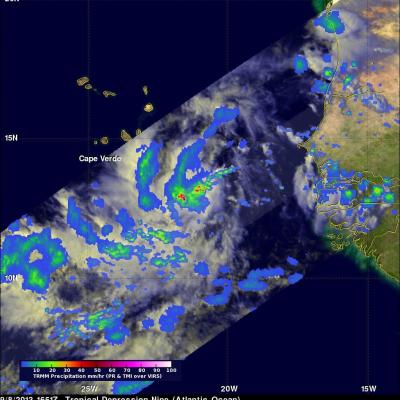
As predicted by the National Hurricane Center (NHC) tropical depression Nine formed with a strong tropical wave that moved from the African coast to an area south of the Cape Verde Islands. The low pressure center was designated tropical depression Nine at 2100 UTC (5PM EDT). The TRMM satellite flew directly above the developing tropical depression earlier at 1651 UTC (12:51 PM EDT). This TRMM pass found rain falling at a rate of over 101mm/hr (~4 inches) near the center of the developing tropical depression. TRMM's PR instrument was used to show a 3-D view of TD9. Radar reflectivity values