Clouds

Why Do Raindrop Sizes Matter In Storms?

Submitted by JacobAdmin on Thu, 03/31/2016
Video Embed

Not all raindrops are created equal. The size of falling raindrops depends on several factors, including where the cloud producing the drops is located on the globe and where the drops originate in the cloud. For the first time, scientists have three-dimensional snapshots of raindrops and snowflakes around the world from space, thanks to the joint NASA and Japan Aerospace Exploration Agency Global Precipitation Measurement (GPM) mission.

Measures Raindrop Sizes From Space
Not all raindrops are created equal. The size of falling raindrops depends on several factors, including where the cloud producing the drops is located on the globe and where the drops originate in the cloud. For the first time, scientists have three-dimensional snapshots of raindrops and snowflakes around the world from space, thanks to the joint NASA and Japan Aerospace Exploration Agency Global Precipitation Measurement (GPM) mission. With the new global data on raindrop and snowflake sizes this mission provides, scientists can improve rainfall estimates from satellite data and in numerical...
White Silence by Gabor Dvornak
This page will automatically redirect you to the GPM "Let it Snow" photo contest winners. If you are not redirected, click here

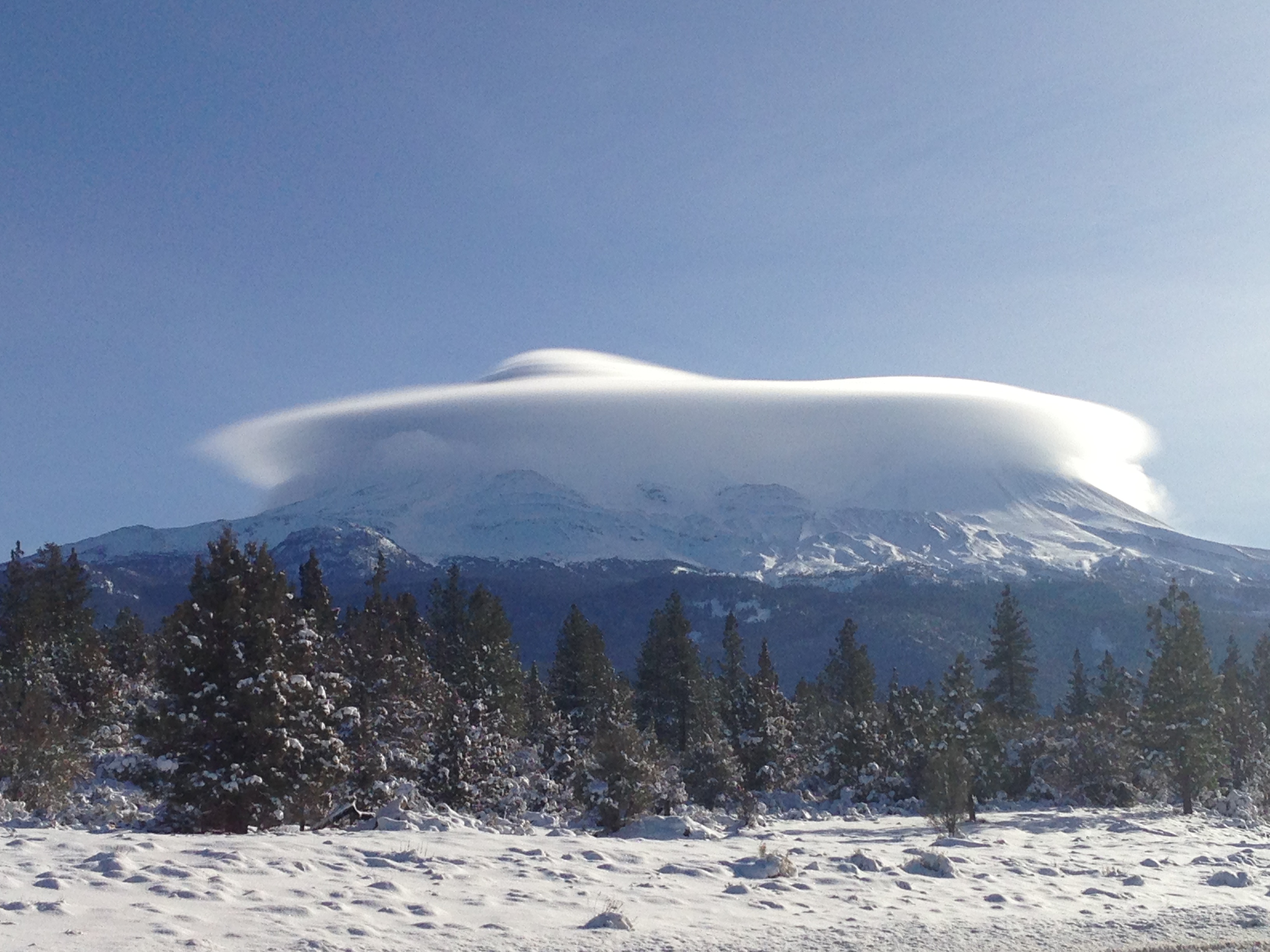
Cloud Hovering Over Mount Shasta, by Gerry Ramos

Cloud Hovering Over Mount Shasta, by Gerry Ramos
Image Caption
Cloud Hovering Over Mount Shasta, by Gerry Ramos

Date and Location:
January 14th, 2013
North Side of Mount Shasta (in Siskiyou County, California), on highway US 97. 

How this Photo Was Taken:
"While driving south on Highway US 97 on the North side of Mt. Shasta, I saw how the cloud was forming into this awesome view. I posted the picture in Instagram and Facebook and my teenage son said 'Dad, that picture looks like an alien spaceship over the mountain.' "

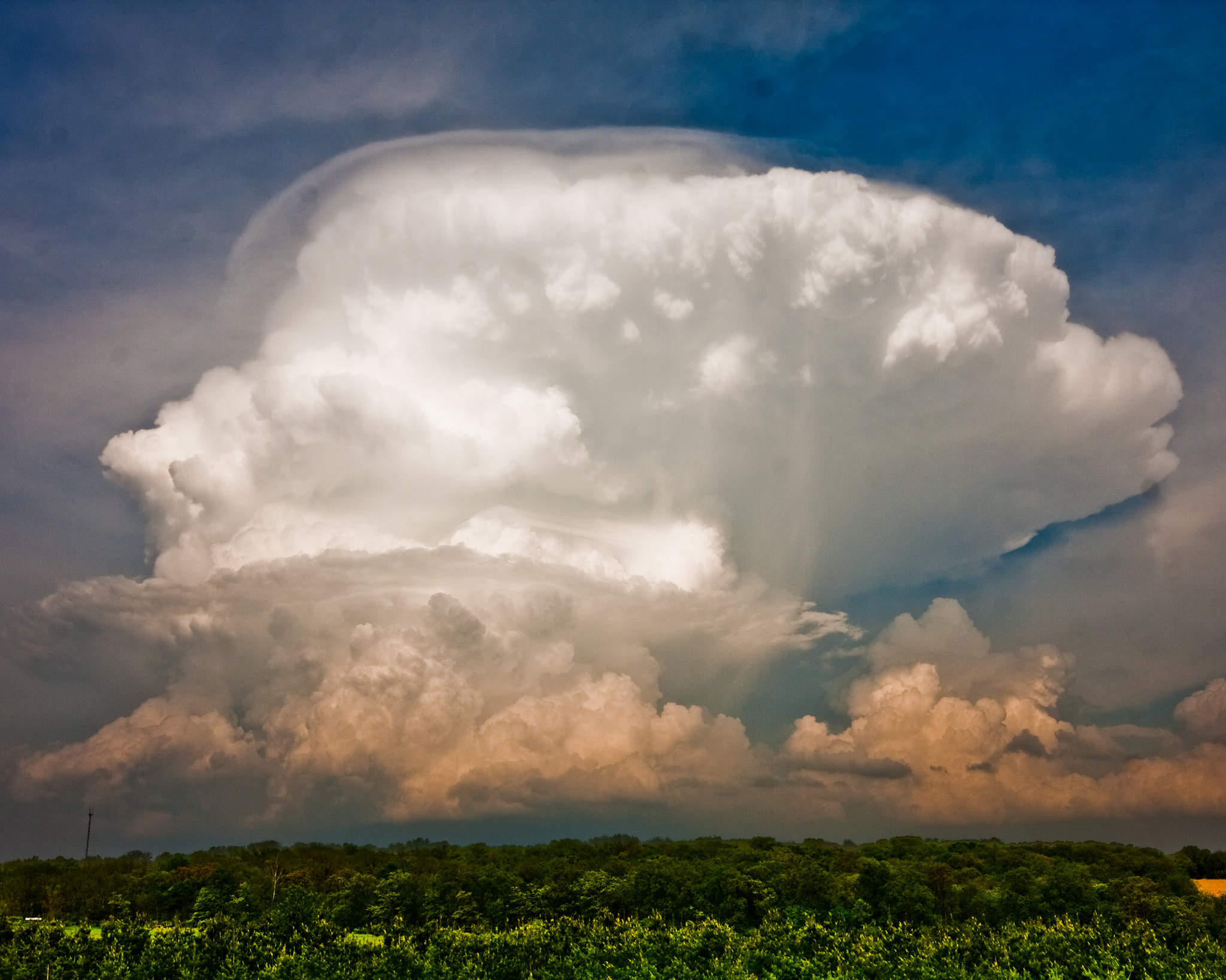
Thunderstorm, by Grant Petty

A huge thunderstorm cloud
Image Caption
A huge thundercloud in Dane County, Wisconsin.

Date and Location:
May 22, 2011
Dane County, Wisconsin

How this Photo was Taken:
“I was out on a farm with a photography club for the purpose of photographing farm life -- animals, barns, etc. I saw this impressive thunderstorm building several miles to the east of where we were and ended up focusing on that while the others in the group continued to follow the goats and horses around. This is one of many examples of how a completely unplanned photo wound up being among my best photos.

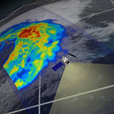
GPM flying over Earth with a data swath visualized.
To augment the observations and provide additional test cases for synthetic algorithm development and satellite simulator testing, a number of modeling activities are also planned. Cloud resolving model simulate frozen precipitation events using the GSFC-Weather Research and Forecasting (WRF) will be performed, initialized and forced by appropriate NWP forecast models. The GSFC WRF has single-moment Goddard Microphysics and spectral-bin microphysics. All of the microphysical schemes have their own set of unique capabilities and assumptions, and all will be tested by the GPM groups. In turn...
GPM flying over Earth with a data swath visualized.
The CERES instrument The Clouds and the Earth’s Radiant Energy System (CERES) instrument is one of five instruments that is being flown aboard the Tropical Rainfall Measuring Mission (TRMM) observatory. The data from the CERES instrument was used to study the energy exchanged between the Sun; the Earth’s atmosphere, surface and clouds; and space. However, it only operated during January - August of 1998, and March 2000, so the available data record is quite brief. Balancing the Earth's Energy Budget The Earth’s daily weather and climate are controlled by the balance between the amount of solar...