Don

Forming Tropical Storm Don's Rain Checked By GPM

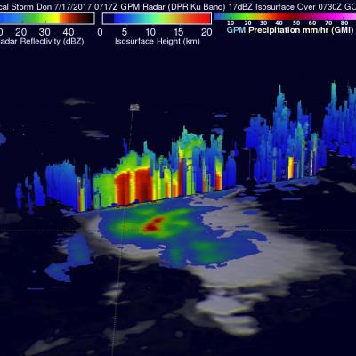
On Monday July 17, 2017 at 5:00 PM EDT a tropical disturbance in the Atlantic Ocean was upgraded to tropical storm Don, the fourth Atlantic Tropical storm of 2017. The GPM core observatory satellite flew above the forming tropical storm much earlier in the same day at 3:17 AM EDT (0717 UTC). GPM's Microwave Imager (GMI) and Dual-Frequency Precipitation Radar (DPR) instruments collected data that were used to evaluate precipitation within the forming tropical cyclone. GPM's Radar data swath (shown in lighter shades) covered an area to the west of the greatest amount of rainfall. GPM's radar

TRMM Sees Don At Daybreak

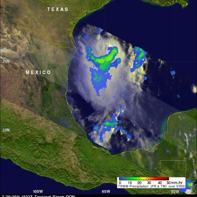
The TRMM satellite again viewed tropical storm DON on 29 July 2011 at 1322 UTC (7:22 AM CDT). A rainfall analysis from TRMM's Microwave Imager (TMI) was overlaid on a sunlit combination visible/infrared image from TRMM's Visible and Infrared Scanner (VIRS) instrument. Below is an animation that fades between the sunlit visible/infrared image and the PR/TMI rainfall analysis.

Tropical Storm Don Approaching Texas

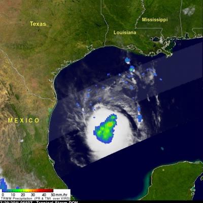
The TRMM satellite passed over tropical storm DON on 29 July 2011 at 0650 UTC (1:50 AM CDT) while the storm was in the Gulf Of Mexico. TRMM's Microwave Imager (TMI) data were used in the image on the right to show rainfall overlaid on an infrared image from TRMM's Visible and InfraRed Scanner (VIRS) instrument. This image shows that DON had become larger and better organized since last seen by TRMM. Also the area of rainfall was larger with some moderate to heavy rainfall located near the storm's center. Texas has been suffering from extreme drought this year so DON's rainfall may provide some
Tropical Storm Don Forms In The Gulf Of Mexico JacobAdmin Thu, 07/28/2011
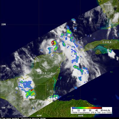
An area of disturbed weather in the southern Gulf Of Mexico was upgraded by the National Hurricane Center (NHC) to tropical storm DON on 27 July 2011 at 2100 UTC (4 PM CDT). The TRMM satellite had a fairly good view of tropical Storm DON when it passed over on 28 July 2011 at 0609 UTC (2:09 AM EDT). A red tropical storm symbol shows the position, north of Mexico's Yucatan peninsula, where DON was located at that time. A rainfall analysis from TRMM's Microwave Imager (TMI) data shows that DON was dropping moderate to heavy rainfall in the eastern side of the small storm. The NHC predicts that

Tropical Wave (90L) Forming in the Caribbean

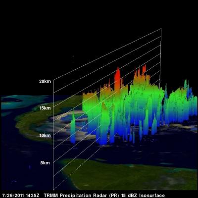
On 26 July at 1435 UTC (10:35 AM EDT) the TRMM satellite passed above a tropical wave in the Caribbean Sea southwest of Cuba. On 27 July this area was given a high (80%) probability of development into a tropical cyclone by the National Hurricane Center (NHC). TRMM's Precipitation Radar (PR) data indicates that a convective tower within this area of disturbed weather reached to heights of over 15 km (~9.3 miles).