Ernesto

Tropical Storm Ernesto In The Gulf Of Mexico

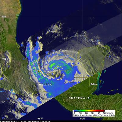
The TRMM satellite saw Ernesto on August 9, 2012 at 0656 UTC ( 2:36 AM EDT) after the tropical storm had moved from the Yucatan Peninsula into the Gulf of Mexico. An analysis of TRMM Microwave Imager (TMI) and Precipitation Radar (PR) rainfall is shown in the image above. This analysis shows that powerful convective thunderstorms were dropping rain at a rate greater than 50mm/hr (~2 inches) north of the storm's center. TRMM Precipitation Radar (PR) data were used in the image below to show a 3-D view of Ernesto's vertical structure. This PR view shows that a few of the powerful convective

Tropical Storm Ernesto Approaches The Yucatan

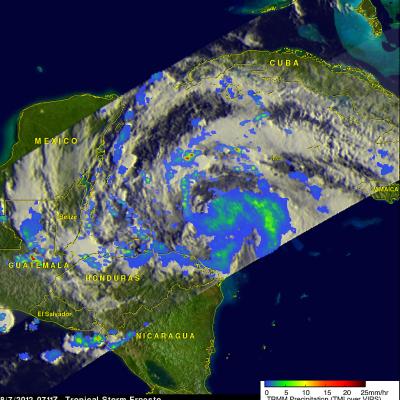
The TRMM satellite passed over tropical storm Ernesto on 7 august 2012 at 0711 UTC ( 3:11 AM EDT) as it was heading toward the Yucatan Peninsula. TRMM's Microwave Imager (TMI) and Precipitation Radar (PR) instruments show that Ernesto was a little better organized with bands of moderate to occasionally heavy rainfall spiraling into the center of the storm's circulation. A few powerful convective storms are shown located in these widely separated rain bands. The National Hurricane Center (NHC) predicts that Ernesto will be a category one hurricane on the Saffir-Simpson scale with winds of about