Fernand

Tropical Storm Fernand Causes Deadly Mudslides

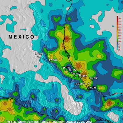
Heavy rain with tropical storm Fernand generated mudslides that caused the reported deaths of 13 people in the Mexican state of Veracruz. TRMM precipitation data are used to calibrate rainfall estimates from other satellites. The resulting TRMM- based, near-real time Multi-satellite Precipitation Analysis (TMPA) at the NASA Goddard Space Flight Center is used to estimate rainfall over a wide portion of the globe. The analysis above shows estimated TMPA rainfall totals for the period from August 20-27, 2013 when Fernand was developing and moving through the area. Total Rainfall greater than

Tropical Storm Fernand Over Eastern Mexico

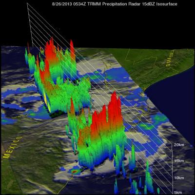
Tropical storm Fernand was drenching the state of Veracruz on Mexico's Gulf Of Mexico coast when the TRMM satellite flew over on August 26, 2012 at 0534 UTC. A rainfall analysis from TRMM's Microwave Imager (TMI) and Precipitation Radar (PR) instruments is shown overlaid on an enhanced infrared image from TRMM's Visible and InfraRed Scanner (VIRS). TRMM PR found rain falling at a rate of over 118mm/hr (~4.6 inches) in rain bands north of Fernand's center of circulation. TRMM PR data revealed that Fernand had a fairly well defined center. TRMM's Precipitation Radar (PR) data were used in the