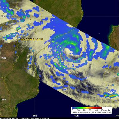
Tropical Cyclone Funso
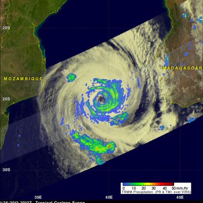
The TRMM satellite saw directly into the eye of tropical Cyclone Funso on 26 January 2012 at 2013 UTC. TRMM Microwave Imager (TMI) and Precipitation Radar (PR) rainfall shows that frequent moderate to heavy rainfall was located in bands around Funso. TRMM PR data show that the tallest storm towers , reaching to about 12km (~7.5 miles), were located in a feeder band southwest of the eye.