GPM Core Observatory

The Evolution of NASA Precipitation Data
NASA’s global precipitation data and data processing systems have come a long way from the launch of TRMM in 1997 to the ongoing GPM mission. Just before midnight Eastern Daylight Time on June 15, 2015, a fireball appeared over central Africa, streaked across Madagascar, and tracked across the uninhabited Southern Indian Ocean. This was the fiery end of the joint NASA/Japan Aerospace Exploration Agency (JAXA) Tropical Rainfall Measuring Mission (TRMM). TRMM’s homecoming after more than 17 years in orbit also marked the end of the first major satellite mission specifically designed to gather...

GPM Gets a Ton of Kilo

Submitted by JacobAdmin on Mon, 09/21/2015
Video Embed

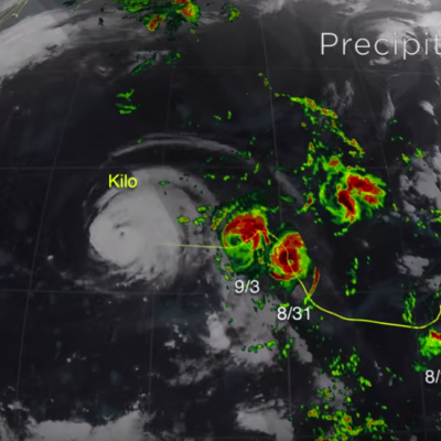
The Global Precipitation Measurement (GPM) mission core satellite provided many views of Tropical Cyclone Kilo over its very long life. GPM is a satellite co-managed by NASA and the Japan Aerospace Exploration Agency that has the ability to analyze rainfall and cloud heights. GPM was able to provide data on Kilo over its 21 day life-span. 

https://www.youtube.com/watch?v=8eIwMXnU8IA&feature=youtu.be
A narrated visualization of Typhoon Kilo. Click here for a full transcript. Click here to download this video in high resolution from the NASA Goddard Scientific Visualization Studio. The Global Precipitation Measurement (GPM) mission core satellite provided many views of Tropical Cyclone Kilo over its very long life. GPM is a satellite co-managed by NASA and the Japan Aerospace Exploration Agency that has the ability to analyze rainfall and cloud heights. GPM was able to provide data on Kilo over its 21 day life-span. The GPM core observatory satellite flew over Kilo on August 25, 2015 at...
GPM's Worldwide Tour of Global Precipitation
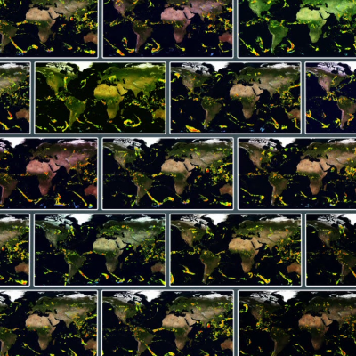
Rain, snow, hail, ice, and every mix in between make up the precipitation that touches everyone on our planet. But precipitation doesn't fall equally in all places around the world, as seen in NASA's new animation that captures every shower, snowstorm and tropical cyclone over a six-day period in August 2014. The time lapse was created from data captured by the Global Precipitation Measurement (GPM) satellite mission, now just over a year old, which scientists are using to better understand freshwater resources, natural disasters, crop health and more. Image Credit: NASA's Goddard Space Flight...
3D Views of February Snow Storms from GPM
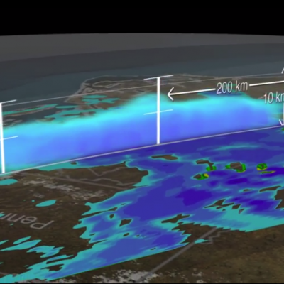
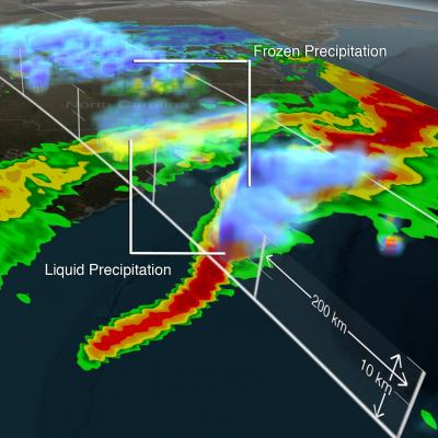
Download this video in HD formats from NASA Goddard's Scientific Visualization Studio The Global Precipitation Measurement (GPM) Core Observatory captured a 3-D image of a winter storm on Feb. 17, 2015, that left 6 to 12 inches of snow over much of Kentucky, southwestern West Virginia and northwestern North Carolina. The shades of blue indicate rates of snowfall, with more intense snowfall shown in darker blue. Intense rainfall is shown in red. The imagery shows great variation in precipitation types over the southeastern United States. Download this video in HD formats from NASA Goddard's...

GPM Sees Nor'easter Dump Snow on New England

Submitted by JacobAdmin on Wed, 01/28/2015
Video Embed

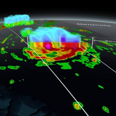
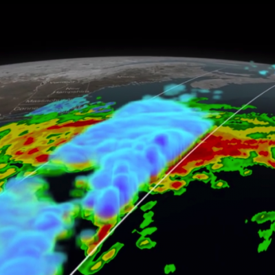
At 5:05 p.m. EST Monday, Jan. 26, 2015, the Global Precipitation Measurement mission's Core Observatory flew over the Nor'easter that dumped snow on New England. This satellite image shows the rate of rainfall, with low amounts in green and high in red, and snowfall, in blue to purple. The center of the storm, shown in 3-D, was offshore with far reaching bands of snowfall. More intense snow rates are shown in darker blue, which can be seen on the northern edge of the storm.

Signs of Spring Spring Weather What is spring to you?  Spring around the world March 20 - launch of contest
At 5:05 p.m. EST Monday, Jan. 26, 2015, the Global Precipitation Measurement mission's Core Observatory flew over the Nor'easter that dumped snow on New England. This satellite image shows the rate of rainfall, with low amounts in green and high in red, and snowfall, in blue to purple. The center of the storm, shown in 3-D, was offshore with far reaching bands of snowfall. More intense snow rates are shown in darker blue, which can be seen on the northern edge of the storm. Visible in the 3-D image of the center of the storm are the snowy tops of the clouds in blue and underneath where it...
GPM Data from a March 2014 Snostorm
Image Credit: NASA's Goddard Space Flight Center Download this video in HD formats from NASA Goddard's Scientific Visualization Studio The most accurate and comprehensive collection of rain, snowfall and other types of precipitation data ever assembled now is available to the public. This new resource for climate studies, weather forecasting, and other applications is based on observations by the Global Precipitation Measurement (GPM) Core Observatory, a joint mission of NASA and the Japan Aerospace Exploration Agency (JAXA), with contributions from a constellation of international partner...

Level 2 GPM Microwave Imager (GMI) Data Released

The Global Precipitation Measurement (GPM) mission's Precipitation Processing System at NASA’s Goddard Space Flight Center in Greenbelt, Maryland, has released the Level 2 GPM Microwave Imager (GMI) data to the public. The data set includes precipitation rates, which show how much rain and snowfall accumulate over a given time period. This Level 2 data set of falling rain and snow is computed from Level 1 brightness temperature observations from GMI, the basic measurement made by the instrument of naturally occurring energy radiated, in this case, by precipitation particles (raindrops or

GPM Performs Maneuvers, Continues Calibration

The GPM spacecraft continues to perform normally. The GPM Microwave Imager and Dual-frequency Precipitation radar continue operations and calibration. The spacecraft performed two routine maneuvers. The first was a 180-degree yaw (left/right in the horizontal plane) turn. This is the second yaw turn that changes the orientation of the spacecraft; it is now flying forwards again. Yaw turns are performed approximately every 40 days for thermal control, as the angle between the spacecraft's orbit and the sun changes. This keeps the side of the spacecraft designed to remain cold from overheating