GPM Core Observatory
GPM in Final Orbit, DPR Calibration Continues
Core Observatory Commissioning Continues
GPM's Stormy New View
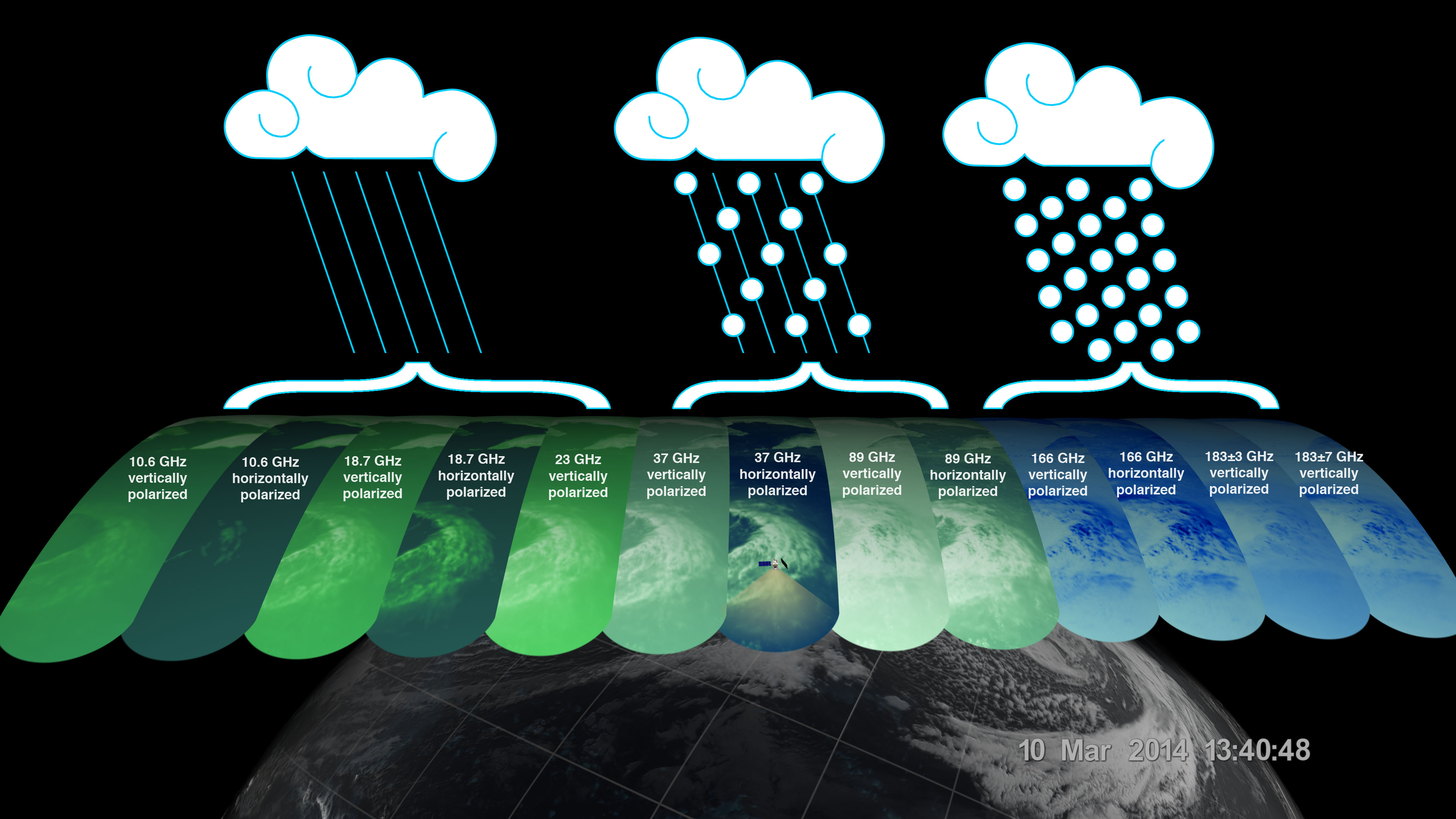
13 Channels of the GMI
First Images from GPM
First Images from GPM
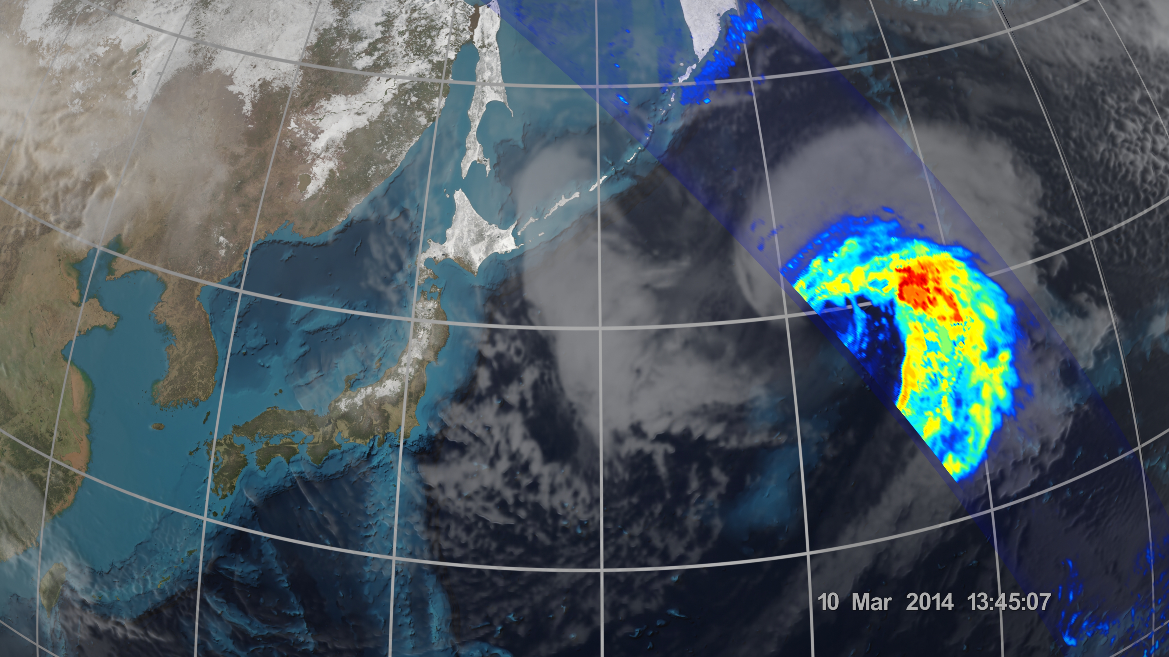
The storm formed from the collision of a cold air mass wrapping around a warm air mass, emerging over the ocean near Okinawa on March 8. It moved northeast over the ocean south of Japan, drawing cold air west-to-east over the land, a typical winter weather pattern that also brought heavy snow over Hokkaido, the northernmost of the four main islands. After the GPM images were taken, the storm continued to move eastward, slowly intensifying before weakening in the central North Pacific.
First Images from GPM Dual-Frequency Precipitation Radar
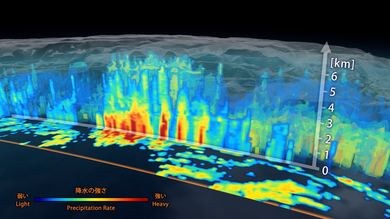
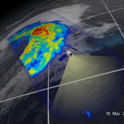
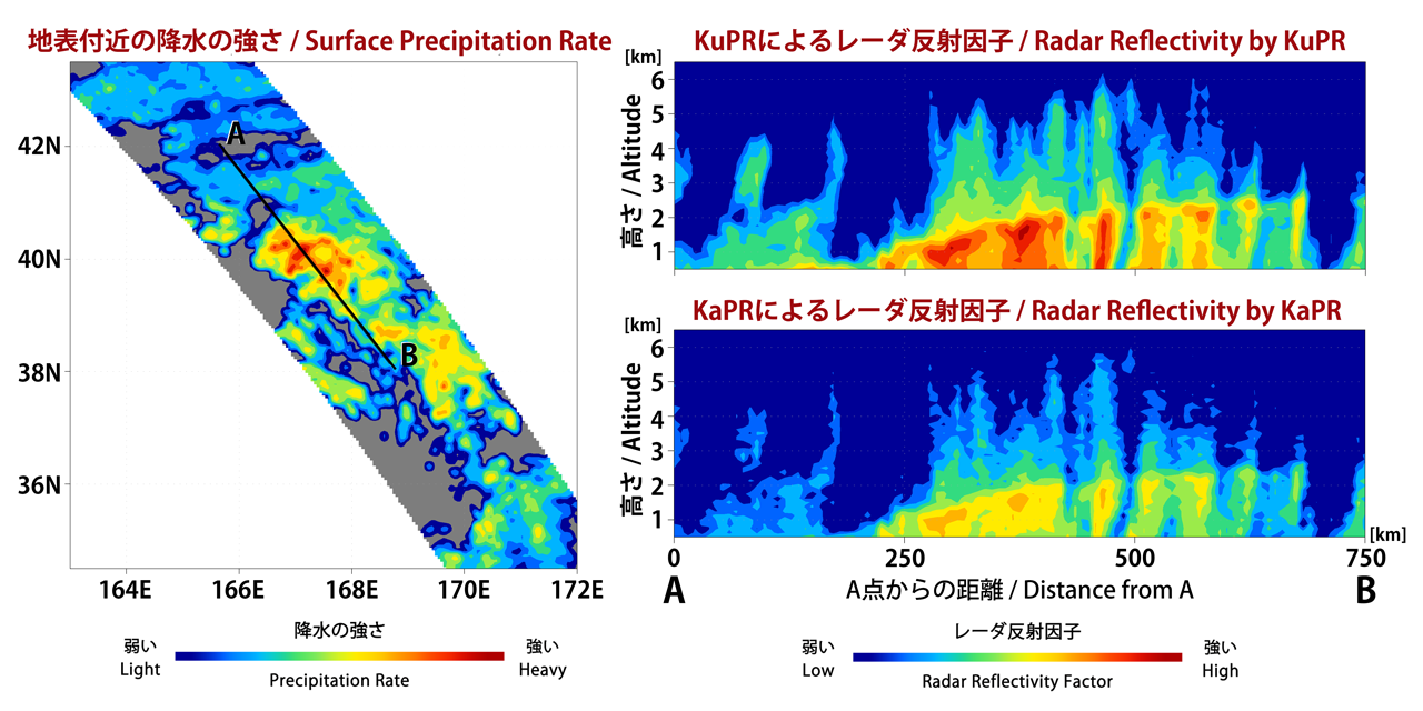
First data visualization of the three-dimensional structure of precipitation collected by the Dual-frequency Precipitation Radar aboard the Global Precipitation Measurement (GPM) mission's Core Observatory. The image shows rain rates across a vertical cross-section approximately 4.4 miles (7 kilometers) high through an extra-tropical cyclone observed off the coast of Japan on March 10, 2014. The DPR 152-mile (245 kilometers) wide swath is nested within the center of the GPM Microwave Imager's wider observation path.
First Images from GPM Microwave Imager
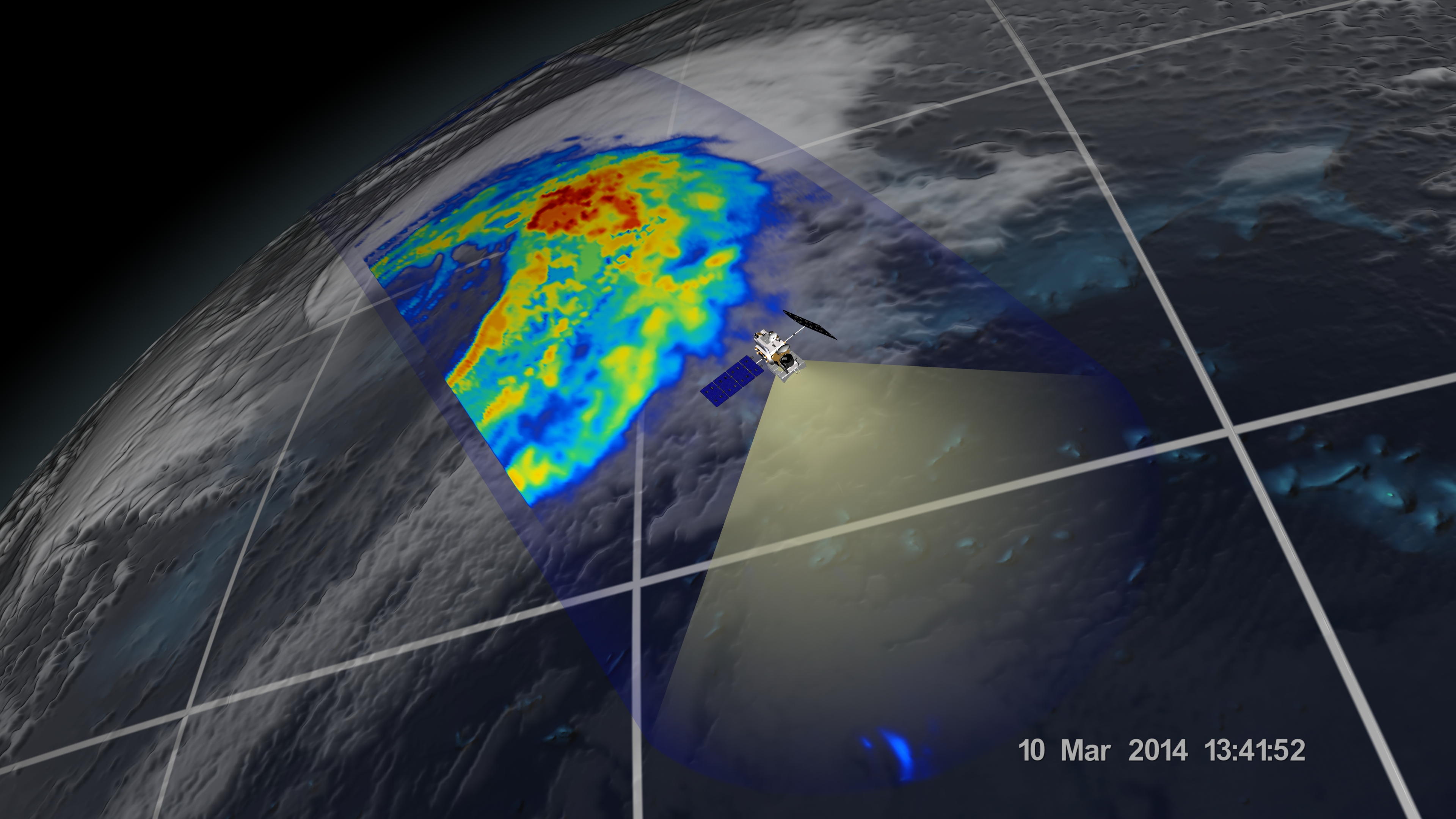
The image shows rain rates across a 550-mile (885 kilometer) wide swath of an extra-tropical cyclone observed off the coast of Japan on March 10, 2014. Red areas indicate heavy rainfall, while yellow and blue indicate less intense rainfall. In the northwest part of the storm in the upper left of the image, the blue areas indicate falling snow.


