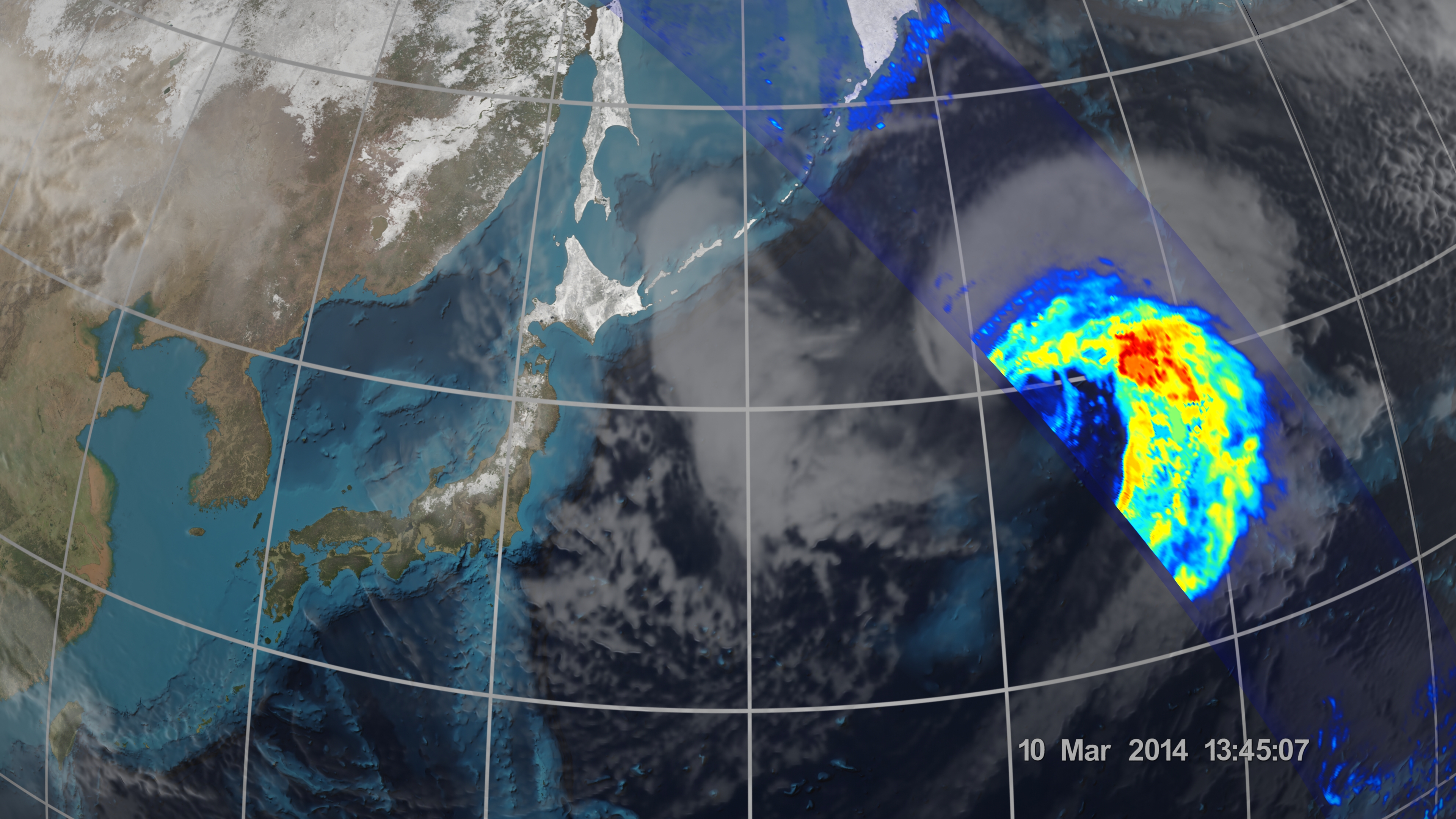
On March 10, the Core Observatory passed over an extra-tropical cyclone about 1055 mi (1700 km) due east of Japan's Honshu Island.
The storm formed from the collision of a cold air mass wrapping around a warm air mass, emerging over the ocean near Okinawa on March 8. It moved northeast over the ocean south of Japan, drawing cold air west-to-east over the land, a typical winter weather pattern that also brought heavy snow over Hokkaido, the northernmost of the four main islands. After the GPM images were taken, the storm continued to move eastward, slowly intensifying before weakening in the central North Pacific.
Credits
NASA / JAXA
Keywords

