Ian

IMERG analysis of Hurricane Ian
On Sept. 30, 2022, Hurricane Ian was approaching South Carolina, which was one day after Ian finished its west-to-east crossing of Florida. NASA has been estimating Hurricane Ian's precipitation over land and ocean, which complements the array of detailed observations collected by NOAA and other agencies of Ian's impact over land.
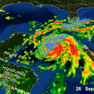
GPM overpass of Hurricane Ian on Sept. 26, 2022
Hurricane Ian became one of the strongest hurricanes on record to strike Florida when it made landfall Wednesday, Sept. 28th, 2022, around 3:10 pm (EDT) as a Category 4 storm near Cayo Costa, FL, about 20 miles west-southwest of Punta Gorda on Florida’s southwest coast. This same area was hit hard by Hurricane Charley in 2004, which also made landfall as a strong Category 4 storm. Both storms passed over and were intensified by the deep, warm waters of the southeastern Gulf of Mexico. Ian originated from a tropical easterly wave that propagated westward off the coast of Africa across the
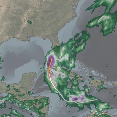
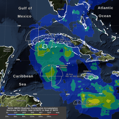
IMERG precipitation totals from Hurricane Ian
Hurricane Ian formed in the Caribbean Sea on Sept. 26, 2022. Ian intensified to Category 3 hurricane on the Saffir-Simpson scale by the time it made landfall in western Cuba early the next day. NASA's near real-time IMERG algorithm was used to estimate the precipitation from Ian during its formation and intensification. IMERG shows that Ian's largest rainfall accumulation so far, over 12 inches, occurred while it was only a tropical storm and not yet a hurricane. The National Hurricane Center provided an estimate of the distance that tropical storm-force winds extended from Ian's low-pressure

TRMM's Sees Deadly Ian Hitting Tonga

Tropical cyclone IAN meandered in an area of the Pacific Ocean between Fiji and Tonga as it intensified from tropical storm intensity with winds of 35kts (~41 mph) on January 5, 2014 to a deadly tropical cyclone with winds of 125kts (~144 mph) on January 11, 2014. Tropical cyclone IAN caused extensive damage and an unknown number of deaths when it passed through Tonga at the peak of it's intensity. The TRMM satellite provided excellent coverage of IAN with multiple passes directly above the tropical cyclone. Rainfall data collected by TRMM's Microwave Imager (TMI) and Precipitation Radar (PR)

Two Southern Hemisphere Tropical Cyclones

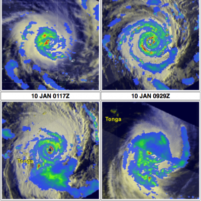
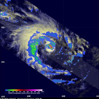
Today the TRMM satellite passed above two tropical cyclones in the southern hemisphere. On January 10,2014 at 0117 UTC TRMM had a good daytime view of intensifying tropical cyclone IAN in the south Pacific Ocean east of Fiji with wind speeds over 90kts (~104 mph). Then at 0724 UTC TRMM passed directly above tropical cyclone Colin in the south Indian Ocean that was also intensifying with wind speeds estimated to be above 35kts (~40 mph). Rainfall derived from TRMM's Precipitation Radar (PR) and Microwave Imager (TMI) data was overlaid on Visible/Infrared images from the Visible and InfraRed

Ian, First 2014 South Pacific Tropical Cyclone

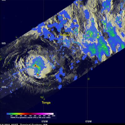
Tropical cyclone IAN became the first tropical cyclone of the 2013-2014 South Pacific season when it formed yesterday north of Tonga. The TRMM satellite passed above IAN this morning at 1133 UTC. IAN is a small tropical cyclone but TRMM's Precipitation Radar (PR) instrument found that IAN was dropping rain at a rate of over 113 mm/hr (~4.4 inches) in some areas. Since it was launched on November 27, 1997 TRMM's Precipitation Radar (PR) has been providing 3-D vertical profiles of rain and snow from the surface up to a height of about 12 miles (20 kilometers). A 3-D view of IAN's vertical