Pakhar

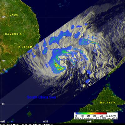
Pakhar Becomes a Typhoon

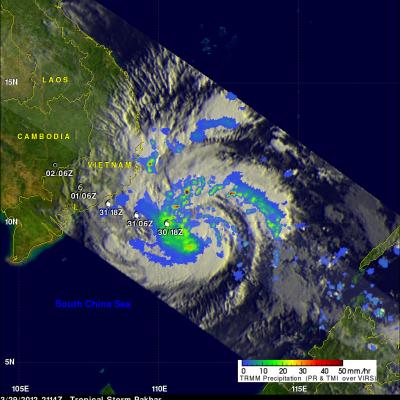
Tropical storm Pakhar was upgraded to typhoon intensity shortly after the TRMM satellite passed over head again on 29 March 2012 at 2114 UTC. An analysis of TRMM Microwave Imager (TMI) and Precipitation Radar (PR) rainfall are shown overlaid on an enhanced infrared image from the Visible and InfraRed Scanner (VIRS) instrument. TMI rainfall data indicated that the largest area of precipitation was located to the southwest of the storm's center. PR data shows that there were scattered powerful storms around Pakhar dropping rainfall at a rate of over 50mm/hr (~2 inches). Pakhar's is forecast to

Typhoon Pakhar Moving Toward Vietnam

The TRMM satellite flew almost directly over a newly formed tropical storm in the South China Sea on 29 March 2012 at 1122 UTC. Pakhar is the first typhoon to form in the northern hemisphere this year. The intensifying storm had wind speeds of about 45 kts (~52 mph) and was moving toward the west-northwest when viewed by this TRMM pass. Pakhar is predicted to be stronger with wind speeds of at least 60 kts (~69 mph) when it crosses into southeastern Vietnam on 31 March 2012. The rainfall analysis above used data from TRMM's Microwave Imager (TMI) and Precipitation Radar (PR) instruments. It