US

A Tale of Two Extremes: Rainfall Across the US
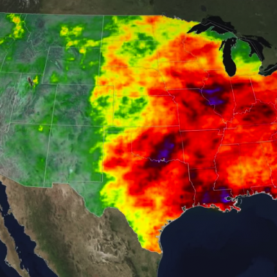
The United States has seen a tale of two extremes this year, with drenching rains in the eastern half of the country and persistent drought in the west. A new visualization of rainfall data collected from space shows the stark contrast between east and west for the first half of 2015. The accumulated precipitation product visualized here begins on Jan. 1, 2015, and runs through July 16, 2015. This visualization shows the heavy rainfall throughout Northern Texas and across Oklahoma as well as the drought in Southern California. Credits: NASA Goddard's Scientific Visualization Studio Download...

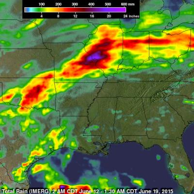
IMERG Sees Heavy Rain Over United States

During the past week the combination of tropical storm Bill's landfall and a slowly moving frontal system extending from the Midwest to the Northeastern states dropped extreme rainfall from Texas' Gulf coast to the northeastern states. Data from NASA's Integrated Multi-satellitE Retrievals for GPM (IMERG) were used in this analysis to estimate the extreme amount of rain that fell during the past seven days. Tropical Storm Bill and it's remnants caused very heavy rainfall while moving through Texas and Oklahoma. Over a foot of rain was reported in Oklahoma resulting in at least two deaths. The

TRMM Sees Tornadic Thunderstorms

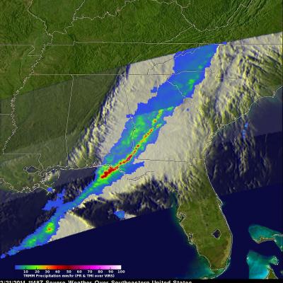
The TRMM satellite passed above a line of severe thunderstorms over the eastern United States on February 21, 2014 at about 1148UTC (6:48 AM EST). Several reports of tornadoes in Illinois were associated with this system yesterday. A possible tornado was reported in Georgia this morning. The 3-D image below shows a TRMM Precipitation Radar (PR) slice through the line of severe thunderstorms. One tall thunderstorm in the Florida panhandle was shown reaching heights of about 13.8km (~8.5 miles) and returning Radar reflectivity values of over 58dBZ to the satellite. Rain was found by TRMM PR to

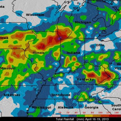
Recent Flooding in the Midwest, 5 Year Anniversary of 2008 Flood

An advancing frontal system extending from the Great Lakes region all the way down to the Gulf Coast supported a line of widespread storms and thunderstorms that brought heavy rain to parts of Iowa, Illinois, Missouri, and Indiana. The hardest hit area was northern Illinois where flooding was reported in and around Chicago. The scenario was set up by a deep upper-level trough that moved out of the Rockies and into the Plains. Strong southerly winds ahead of the trough allowed warm, moist air from the Gulf of Mexico to stream northwards all the way up to Lake Michigan. The TRMM-based, near-real

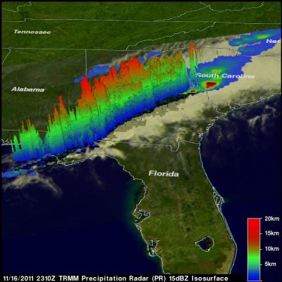
TRMM Sees Deadly Tornadic Thunderstorms

Tornadoes are expected to accompany severe storms in the springtime in the U.S., but this time of year they also usually happen. When a line of severe thunderstorms associated with a cold front swept through the U.S. southeast on Nov. 16, TRMM collected rainfall data on the dangerous storms from space. TRMM's Precipitation Radar (PR) data was used to show the line of severe thunderstorms in 3-D. The line of storms were pushing through North and South Carolina on Nov. 16, 2011. Strong updrafts had pushed precipitation within some of these storms to heights of 15km (9.3 miles). Credit: SSAI/NASA