
Hurricane Irene Passes Through Bahamas and Heads Toward Cape Hatteras
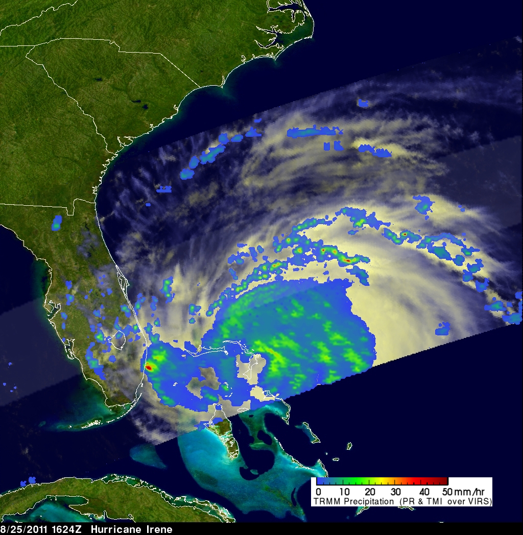
Hurricane Irene was seen affecting the Bahamas twice during the daytime by the TRMM satellite on Thursday 25 August 2011 at 1624 UTC ( 12:24 PM EDT) and at 2118 UTC ( 5:17 PM EDT). A rainfall analysis from TRMM's Microwave Imager (TMI) data shows that Irene's eye had moved to the north of the islands of the Bahamas by the second pass. TRMM' Precipitation Radar (PR) data shows that at this time Irene contained bands of intense thunderstorms dropping rain at the rate of over 50 mm/hr (~2 inches) north of the hurricane's eye.
Irene weakened slightly today (Friday) from a category 3 to a strong category 2 hurricane with winds of 95 kts (~110 mph) as it heads toward Cape Hatteras on the North Carolina Coast.
Click here to see earlier TRMM information about Irene.

See the 25 August 2011 1624 UTC image in GOOGLE EARTH (kml).