Irene

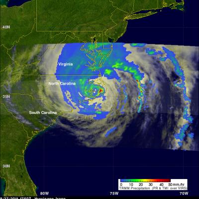
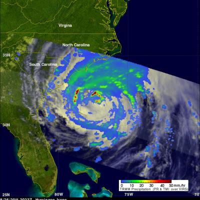
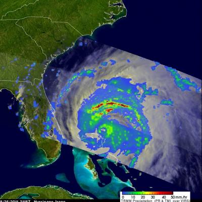
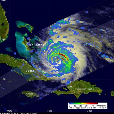
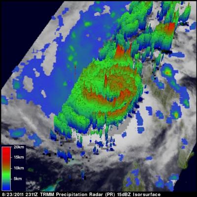
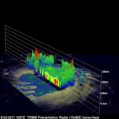
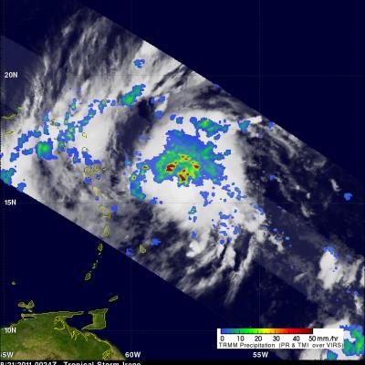
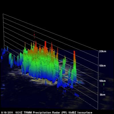
Irene Drenches the Northeastern United States

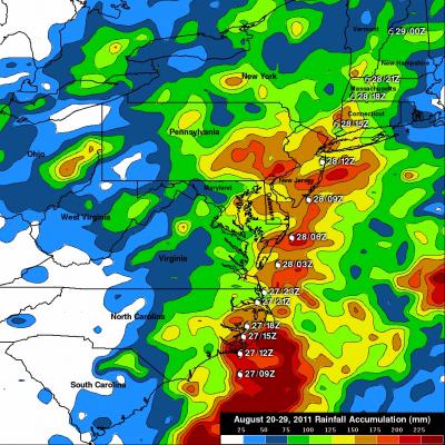
The TRMM-based, near-real time Multi-satellite Precipitation Analysis (MPA) at the NASA Goddard Space Flight Center monitors rainfall over the global tropics. The analysis above shows MPA rainfall totals for the period from 20-29 August 2011. Hurricane Irene was dropping tremendous amounts of rainfall over the eastern United States during a part of this period and caused flooding from the Carolinas to the northeastern states. The heaviest rainfall totals of over 225 mm (~8.9 inches) were located in North Carolina where Irene first made landfall in the United States. Very heavy rainfall

TRMM Views Irene Again Over Cape Hatteras

The TRMM satellite had another very good daytime view of hurricane Irene on 27 August 2011 1750 UTC (1:50 PM EDT). The rainfall analysis shown on the right was derived from TRMM's Microwave Imager (TMI) and Precipitation Radar (PR) data. It clearly shows the location of Irene's eye and the intense rainfall falling over Cape Hatteras east of the eye. Click here to see this image in Google Earth (kml).

TRMM sees Irene Approaching The Carolinas Coast

The TRMM satellite saw hurricane Irene again on 26 August 2011 at 2023 UTC (4:23 PM EDT) when winds had weakened to about 85 kts (~98mph). This TRMM pass showed no clear eye but bands of heavy rainfall north of the center. Irene was predicted by the NHC to weaken a little more before coming ashore in North Carolina. See the 26 August 2011 2023 UTC image in Google Earth (kml).

Hurricane Irene Passes Through Bahamas and Heads Toward Cape Hatteras

Hurricane Irene was seen affecting the Bahamas twice during the daytime by the TRMM satellite on Thursday 25 August 2011 at 1624 UTC ( 12:24 PM EDT) and at 2118 UTC ( 5:17 PM EDT). A rainfall analysis from TRMM's Microwave Imager (TMI) data shows that Irene's eye had moved to the north of the islands of the Bahamas by the second pass. TRMM' Precipitation Radar (PR) data shows that at this time Irene contained bands of intense thunderstorms dropping rain at the rate of over 50 mm/hr (~2 inches) north of the hurricane's eye. Irene weakened slightly today (Friday) from a category 3 to a strong
TRMM image of hurricane Irene intesifying as it nears the Bahamas
UPDATE: Monday, August 29th, 2011 Irene Drenches Northeastern United States UPDATE: Friday, August 26th, 2011 Irene Passes Through the Bahamas, Heads Towards Cape Hatterus Wednesday, August 24th, 2011 After becoming a small hurricane while passing over Puerto Rico, Irene re-emerged over the warm, open waters of the western Atlantic northwest of the Dominican Republic on the morning of August 22nd. The storm quickly showed signs of intensifying as deep convective towers arose near the center of Irene, releasing heat into the core of the system. In response, Irene's central pressure fell and...

Irene Gathers Strength, Takes Aim at the Bahamas

After becoming a small hurricane while passing over Puerto Rico, Irene re-emerged over the warm, open waters of the western Atlantic northwest of the Dominican Republic on the morning of August 22nd. The storm quickly showed signs of intensifying as deep convective towers arose near the center of Irene, releasing heat into the core of the system. In response, Irene's central pressure fell and winds intensified, making it a Category 2 storm on the Saffir-Simpson hurricane intensity scale with sustained winds reported at 85 knots (~100 mph) by the National Hurricane Center by the end of the day

TRMM Gets a Look at Irene, the First Hurricane of the Atlantic Season

It's been a busy season so far in terms of tropical storms with seven named storms already in the Atlantic basin; however, none of them have had a very large impact as they have either been small, short-lived or remained at sea and none of them have intensified into a hurricane until now. Irene, which originated from a tropical wave that propagated off the west coast of Africa, became the 8th named storm of the season as it approached the Lesser Antilles on the 20th of August and the first hurricane of the season as it was passing over Puerto Rico on the morning of the 22nd. Now back over open

Tropical Storm Irene Forms

The National Hurricane Center (NHC) issued it's first advisory for tropical storm Irene on 20 August 2011 at 2300 UTC (7 PM EDT). The TRMM satellite passed over the intensifying storm a little later on 22 August 2011 at 0024 UTC (8:24 PM EDT). Data collected with this orbit showed that Irene contained numerous powerful thunderstorms with TRMM's Precipitation Radar (PR) revealing that some thunderstorm towers near the center of the storm were reaching to heights above 15 km (~9.3 miles). The NHC has forecasted that Irene will become a hurricane within 36 hours while moving in a west