
Hurricane Irene Intensifies
After becoming a small hurricane while passing over Puerto Rico, Irene re-emerged over the warm, open waters of the western Atlantic northwest of the Dominican Republic on the morning of August 22nd. The storm quickly showed signs of intensifying as deep convective towers arose near the center of Irene, releasing heat into the core of the system. In response, Irene's central pressure fell and winds intensified, making it a Category 2 storm on the Saffir-Simpson hurricane intensity scale with sustained winds reported at 85 knots (~100 mph) by the National Hurricane Center by the end of the day. Irene remained at Category 2 intensity most of the following day as it brushed the northern coast of Hispaniola heading west-northwest in the direction the Turks and Caicos Islands. Late in the afternoon on the 23rd, Irene weakened slightly after ingesting some drier air into its circulation. But the effect was short lived as new convective towers signaled that Irene was again ready to re-intensify.
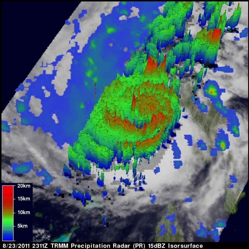
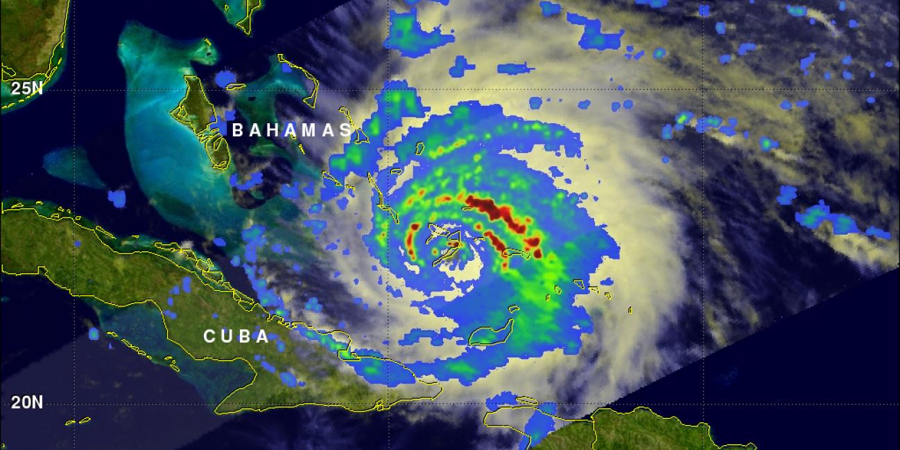
The Tropical Rainfall Measuring Mission (or TRMM) satellite passed directly over Irene late in the day on the 23rd and captured these two images as the storm was bearing down on parts of the Caicos Islands. The images were taken at 23:11 UTC (7:11 PM EDT) on 23 August 2011. The first image shows a top-down view of the rain intensities within Irene. Rain rates in the center of the swath are from the higher resolution TRMM Precipitation Radar (PR), while those in the outer swath are from the TRMM Microwave Imager (TMI). The rainrates are overlaid on visible and infrared (IR) data from the TRMM Visible Infrared Scanner (VIRS). TRMM reveals that although Irene does not have a visible eye (the solid white center shows that it is still completely covered over with cloud), deep down under the cloud tops there is an eye surrounded by a complete eyewall of varying rain intensities as evidenced by the complete circle in the rain field at the center of the image. The northeast corner of the eyewall contains an area of intense rain (darker red area) and the southern portion only light rain (shown in blue) with mostly moderate rain (green areas) in between. The storm is still fairly asymmetrical, however, with most of the surrounding rain northeast of the center.
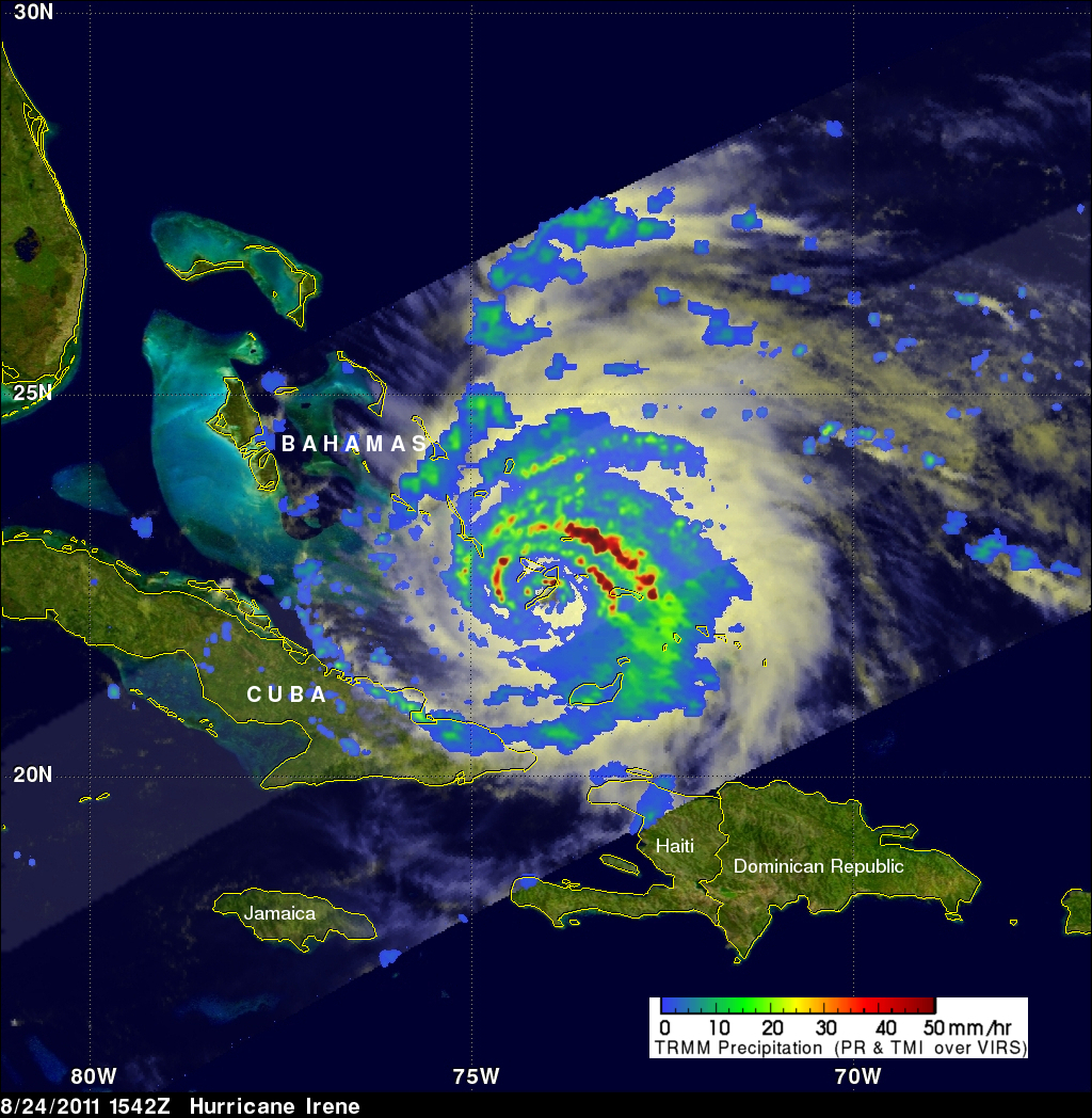
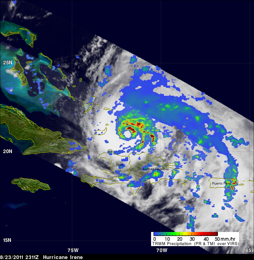
Irene continued to strengthen overnight and by 8 am EDT the next morning on the 24th, it had become a Category 3 storm with sustained winds of 100 knots (~115 mph). The next TRMM image was taken at 15:42 UTC (11:42 am EDT) around midday on the 24th as Irene was passing directly over Crooked Island in the southeast Bahamas. Although the eye is somewhat obscured by the island, Irene did have a visible eye before passing over the island. Unlike the previous image from TRMM, the rainbands surrounding the center are now very tightly wound and are more evenly distributed about the center. These are characteristic of a larger, much more intense circulation as any rain features are quickly smeared around in a circle around the center by the stronger winds.

The last image shows another 3D view of the storm, revealing once again the presence of a deep convective tower within the eyewall. At the time of these last two images, Irene's maximum sustained winds were still 100 knots (~115 mph), but the storm's central pressures were continuing to fall, an indication the storm was in the process of intensifying. Just over two hours later, Irene's maximum sustained winds had risen to 120 mph. Irene is expected to pass through the central Bahamas and could become a Category 4 storm before threatening the US East Coast.
Click to see a 3-D animated flyby mpeg animation of TRMM PR
Click to see the TRMM rainfall image above in Google Earth (.kml)
Click here to see earlier information about Irene
Images produced by Hal Pierce (SSAI/NASA GSFC) and caption by Steve Lang and Hal Pierce (SSAI/NASA GSFC).