Irene Drenches the Northeastern United States
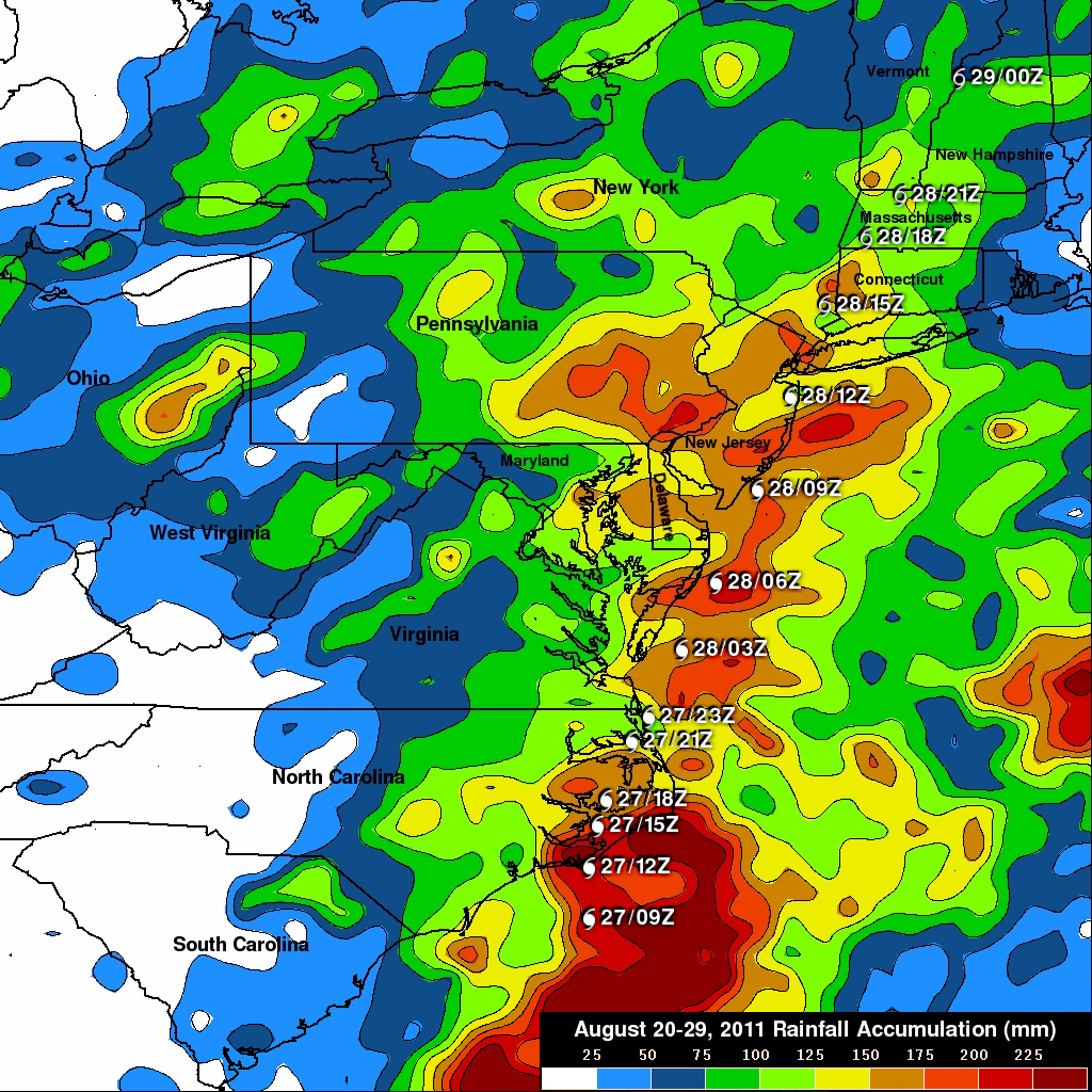
The TRMM-based, near-real time Multi-satellite Precipitation Analysis (MPA) at the NASA Goddard Space Flight Center monitors rainfall over the global tropics. The analysis above shows MPA rainfall totals for the period from 20-29 August 2011. Hurricane Irene was dropping tremendous amounts of rainfall over the eastern United States during a part of this period and caused flooding from the Carolinas to the northeastern states. The heaviest rainfall totals of over 225 mm (~8.9 inches) were located in North Carolina where Irene first made landfall in the United States. Very heavy rainfall resulting in flooding is also shown in northeastern states along the hurricane's track. Irene's flooding in Vermont was described as "epic" in proportion.
Click here to see earlier TRMM information about Irene.