
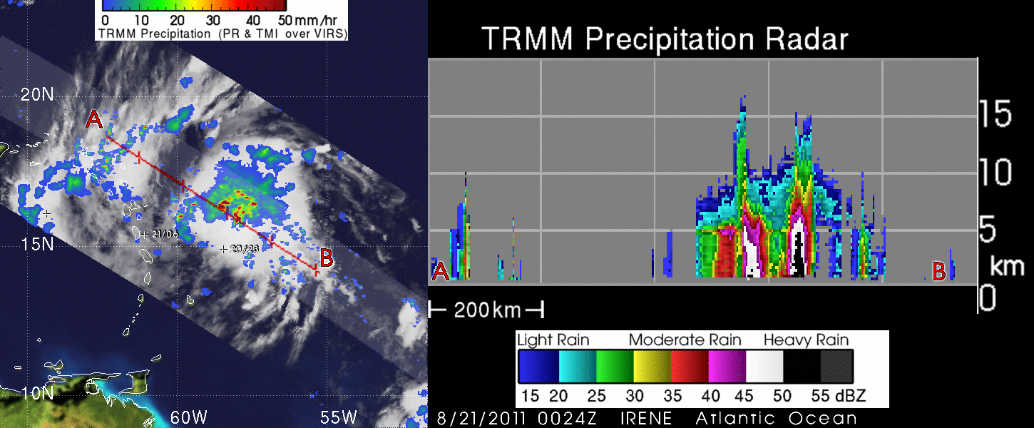
Tropical Storm Irene Forms
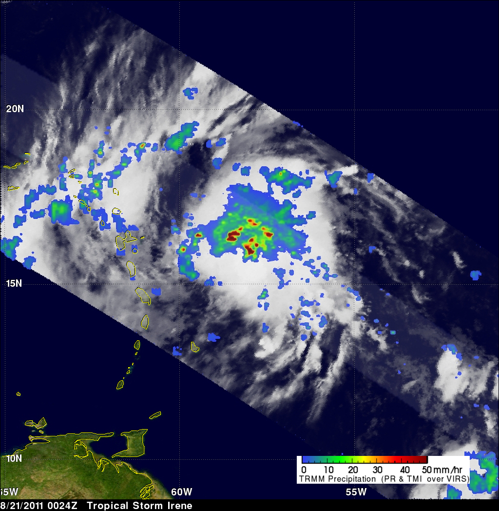
The National Hurricane Center (NHC) issued it's first advisory for tropical storm Irene on 20 August 2011 at 2300 UTC (7 PM EDT). The TRMM satellite passed over the intensifying storm a little later on 22 August 2011 at 0024 UTC (8:24 PM EDT). Data collected with this orbit showed that Irene contained numerous powerful thunderstorms with TRMM's Precipitation Radar (PR) revealing that some thunderstorm towers near the center of the storm were reaching to heights above 15 km (~9.3 miles).
The NHC has forecasted that Irene will become a hurricane within 36 hours while moving in a west-northwesterly direction. This path is forecast to take it over Puerto Rico, Hispaniola, eastern Cuba and then possibly Florida in the next five days. Click here to see TRMM information about Irene's formation.