
Maria Moving to the West of Bermuda
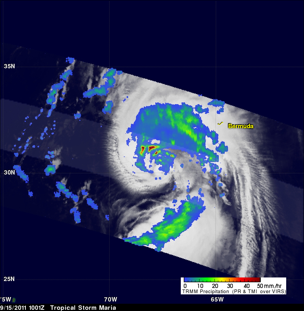
The TRMM satellite traveled above tropical storm Maria on Thursday 15 September 2011 at 1001 UTC ( 6:01 AM EDT). Maria's organization had improved over that seen by TRMM earlier in the week due to favorable (warmer) sea surface temperatures and lower upper level wind shear. A rainfall analysis from TRMM's Precipitation Radar (PR), displayed in a lighter swath, shows that powerful convective storms were dropping rainfall at a rate of over 50mm/hr (~2 inches) northwest of Maria's center of circulation. A large area of rainfall containing bands of heavier rainfall was also shown by TRMM's Microwave Imager (TMI) to be located between the storm's center and Bermuda.
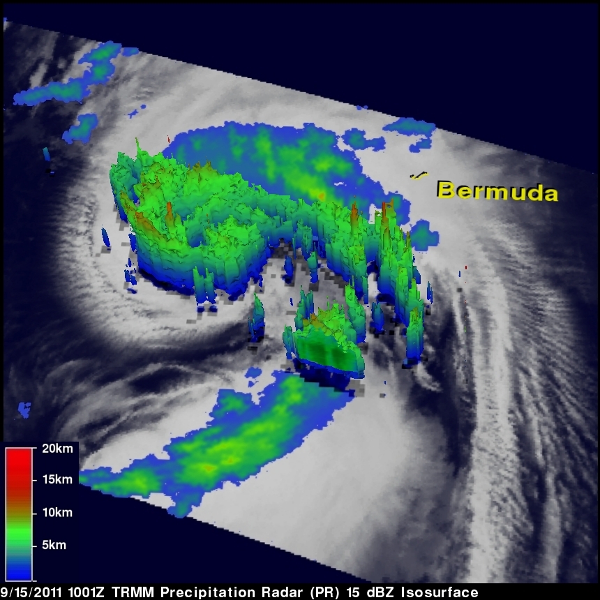
The 3-D image above was derived from TRMM's PR. It reveals that some convective storm towers near Maria's center of circulation reached to heights of over 11km (6.8 miles) and that powerful storms in feeder bands on Maria's western side were over 12km (7.5 miles) high.
The National Hurricane Center (NHC) estimated at 0900 UTC that Maria had wind speeds of 55 kts ( 65 mph). At 1800 UTC ( 2:00 PM EDT), as Maria passes to the west of Bermuda, winds are predicted to reach minimal hurricane strength of 65 kts (75 mph).