Philippe Becomes a Hurricane
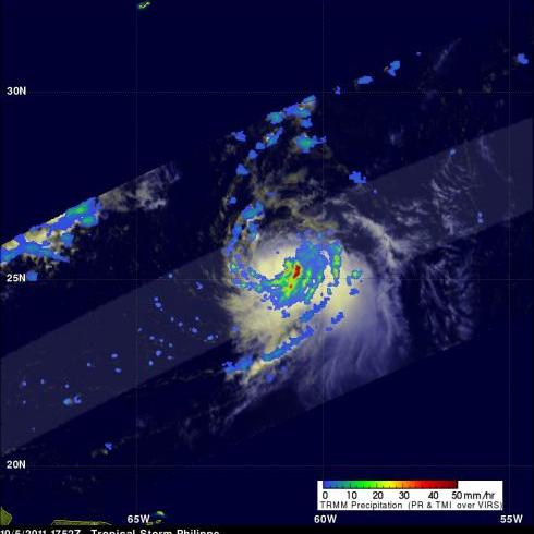
The National Hurricane Center (NHC) upgraded Philippe to a hurricane at 1500 UTC (11 AM EDT) on Thursday 6 October 2011. Earlier TRMM Microwave Imager (TMI) data from the 6 October 2011 at 0024 UTC view shows that tropical storm Philippe's center of circulation had become better defined with an eye wall forming.
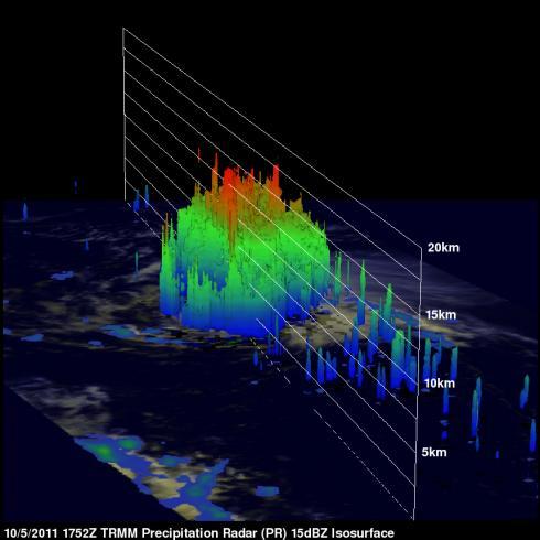
The TRMM satellite also had an excellent look at Philippe earlier on Wednesday 5 October 2011 at 1752 UTC (1:52 PM EDT). TRMM's Precipitation Radar (PR) scanned directly over Philippe and revealed that Philippe had bands of intense rainfall around the southeast side of the center of circulation.
A 3-D rendering of TRMM PR data shows that deep convective towers in this area reached to heights of over 13km (~8 miles).
Click here to see earlier TRMM information about Philippe.


