
Typhoon Brings Heavy Rain to Southern Japan
Typhoon Ma-On formed from an area of disturbed weather in the northwest Pacific halfway between Wake Island and the Northern Marianas on the 11th of July 2011. The system slowly developed and became a typhoon two days later on the 13th as it continued tracking westward. Ma-On then reached its maximum intensity on the 15th with sustained winds estimated at 115 knots (~132 mph), making it a Category 4 typhoon, before turning northward towards southern Japan. Ma-On began to weaken as it neared the southeast coast of Japan where it briefly made landfall in southern Tokushima Prefecture on the Japanese Island of Shikoku as a minimal typhoon with sustained winds reported at 75 mph before recurving back out to sea. Despite its minimal intensity, however, the storm brought very heavy rain to parts of southeastern Japan.
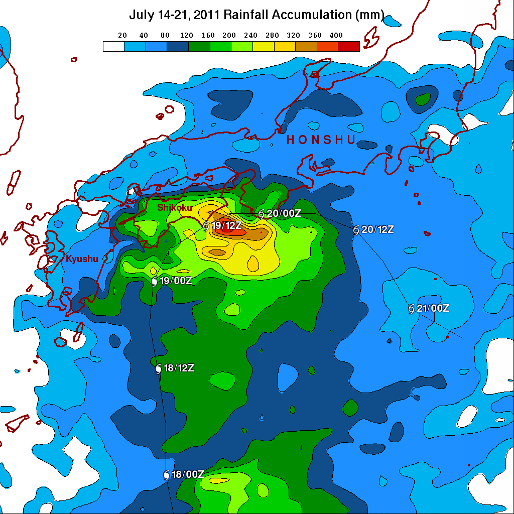
The TRMM-based, near-real time Multi-satellite Precipitation Analysis (TMPA) at the NASA Goddard Space Flight Center is used to monitor rainfall over the global Tropics. TMPA rainfall totals are shown here for the period 14 to 21 July 2011 for southeastern Japan in association with the passage of Ma-On. Appropriate storm symbols denote the storm's track and intensity. Rainfall totals are the highest over Shikoku where MA-ON made landfall. Most of the island received at least 160 mm of rain (~6 inches, shown in green) while the far eastern portion received upwards of 320 mm (~13 inches, shown in orange). Locally a record 850 mm of rain (~34 inches) was reported in a 24-hour period in the village of Umaji in the Kochi Prefecture. So far one person has died as a result of the storm, which is expected to continue to weaken as it pulls away from Japan and pass well to the east of the damaged Fukushima power plant.
Click here to see earlier TRMM information about MA-ON.