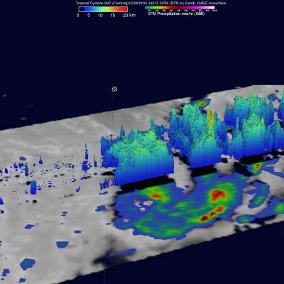
GPM Sees More Powerful Tropical cyclone 06P (ULA)
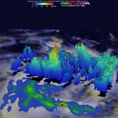
The GPM core observatory satellite had an excellent daytime view of tropical cyclone 06P (ULA) on December 30, 2015 at 2358 UTC. The tropical cyclone had moved to the east-southeast of Samoa in the South Pacific Ocean with maximum sustained winds increasing to about 50 kts (58 mph). The rainfall pattern derived from GPM's Microwave Imager (GMI) and Dual-Frequency Precipitation Radar (DPR) instruments showed that 06P was much better organized. Powerful thunderstorms at the center of the tropical cyclone were found by DPR to be dropping rain at a rate of over 66 mm (2.6 inches) per hour. GPM's