Ula

Powerful Tropical Cyclone Ula Monitored By GPM

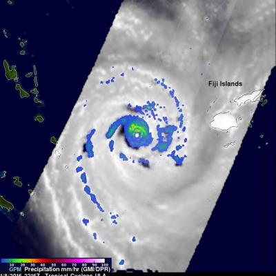
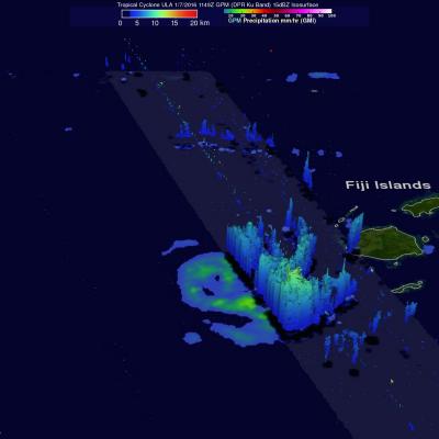
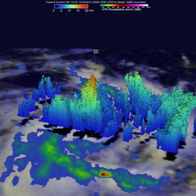
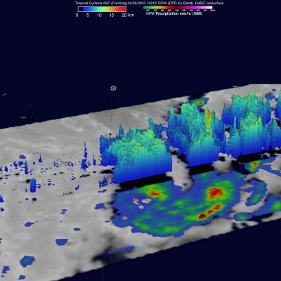
Tropical cyclone ULA's winds peaked at 115 kts (132 mph) over the weekend. These high winds meant that for a couple days ULA was a category four tropical cyclone on the Saffir-Simpson Hurricane Wind Scale. ULA moved over the waters of the North Fiji Basin between the Fiji Islands and New Caledonia before moving southeastward into the South Fiji Basin. The GPM core observatory satellite had good looks at powerful tropical cyclone ULA during it's changes in intensity. On January 8, 2015 at 2216 UTC GPM saw that rain was falling at a rate of over 63.5 mm (2.5 inches) north of the intensifying

GPM Catches Tropical Cyclone Ula Rebounding

Tropical cyclone ULA weakened to tropical storm intensity after passing south of and then to the west of the Fiji Islands in the South Pacific. ULA has now started to intensify again while moving to the southeast of New Caledonia. The GPM core observatory satellite passed above tropical cyclone ULA on January 7, 2016 at 1149 UTC when maximum sustained wind speeds were estimated at 45 kts (52 mph). Rain was measured by GPM's Dual-Frequency Precipitation Radar (DPR) instrument falling at a rate of 68 mm (2.7 inches) per hour in storms on ULA's southern side. Some of these convective storms were

GPM Sees More Powerful Tropical cyclone 06P (ULA)

The GPM core observatory satellite had an excellent daytime view of tropical cyclone 06P (ULA) on December 30, 2015 at 2358 UTC. The tropical cyclone had moved to the east-southeast of Samoa in the South Pacific Ocean with maximum sustained winds increasing to about 50 kts (58 mph). The rainfall pattern derived from GPM's Microwave Imager (GMI) and Dual-Frequency Precipitation Radar (DPR) instruments showed that 06P was much better organized. Powerful thunderstorms at the center of the tropical cyclone were found by DPR to be dropping rain at a rate of over 66 mm (2.6 inches) per hour. GPM's

GPM Sees Tropical Cyclone Forming

The GPM core observatory satellite passed above tropical cyclone 06P when it was forming in the south Pacific Ocean north of Samoa on December 29, 2015 at 1321 UTC. A rainfall analysis was performed using data collected at that time by GPM's Microwave Imager (GMI) and Dual-Frequency Precipitation Radar (DPR) instruments. Data from GMI were used to calculate that rain was falling at a rate of over 83.6 mm (3.29 inches) per in a feeder band northeast of the low's center. Radar data from GPM's DPR Ku band radar were used to show the 3-D structure of precipitation within the forming tropical