Fiji

IMERG Captures Rainfall from Tropical Cyclone Ana in Fiji
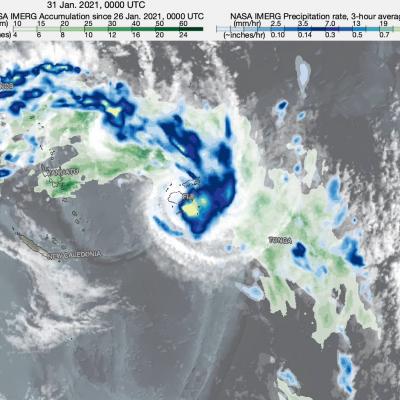
NASA combined data from multiple satellites to estimate the rainfall from Tropical Cyclone Ana in the Southwest Pacific Ocean amid an ongoing Madden-Julian Oscillation (MJO) event. The Madden-Julian Oscillation is a 20 to 90 day pattern of alternating wet and dry conditions that often begins in the tropical Indian Ocean and moves eastward into the Pacific. This animation shows rainfall rates (blue/yellow shading) and rainfall accumulations (green shading) at half-hourly intervals from January 26 - February 2, 2021, using NASA's IMERG algorithm, overlaid on shades of white/gray from NOAA

Tropical Cyclone Keni Drops Heavy Rain Over Fiji With A Direct Hit To Kadavu

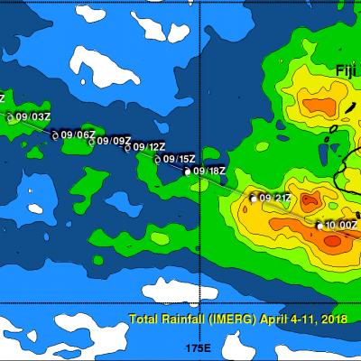
As expected, tropical cyclone KENI followed a track similar to tropical cyclone JOSIE and passed to the southwest of Fiji's main island of Viti Levu on April 10, 2018 (UTC). No casualties were reported with KENI even though it was a more powerful tropical cyclone than JOSIE. KENI was still intensifying when it passed directly over the island of Kadavu located just south of Viti Levu. Flash flooding was reported on Viti Levu and Kadavu. Maximum sustained winds of greater than 70 kts (81 mph) were responsible for widespread damage caused by the direct hit to Kadavu. KENI's peak winds of 85 kts

Tropical Cyclone Josie's Deadly Flooding Rainfall Examined With IMERG

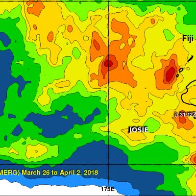
Tropical cyclone Josie didn't make landfall in Fiji but it's heavy rainfall resulted in deadly flooding. Approximate locations of tropical cyclone Josie, as it moved close to Fiji, are shown overlaid in white. Josie's clockwise circulation streamed moisture over Fiji causing flooding that led to the deaths of at least four people. This rainfall accumulation analysis used Integrated Multi-satellitE Retrievals for GPM (IMERG) data. Those data are generated by NASA's Precipitation Processing System every half hour within about 6 hours from when data are acquired. IMERG data are acquired from the

Powerful Tropical Cyclone Ula Monitored By GPM

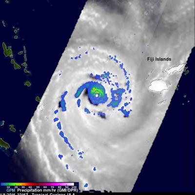
Tropical cyclone ULA's winds peaked at 115 kts (132 mph) over the weekend. These high winds meant that for a couple days ULA was a category four tropical cyclone on the Saffir-Simpson Hurricane Wind Scale. ULA moved over the waters of the North Fiji Basin between the Fiji Islands and New Caledonia before moving southeastward into the South Fiji Basin. The GPM core observatory satellite had good looks at powerful tropical cyclone ULA during it's changes in intensity. On January 8, 2015 at 2216 UTC GPM saw that rain was falling at a rate of over 63.5 mm (2.5 inches) north of the intensifying