Iris

GPM Shows Rainfall Southeast Of Sheared Tropical Cyclone Iris

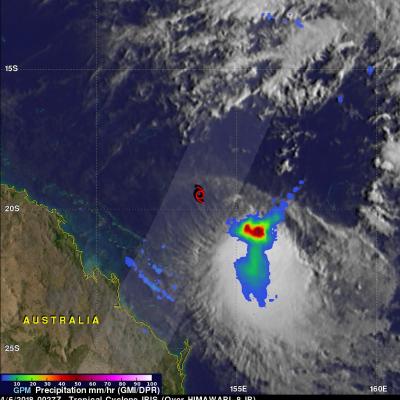
The GPM core observatory satellite again passed over the center of tropical cyclone IRIS on April 6, 2018 at 0027 UTC (10:27 AM AEST). The location of IRIS' low level center of circulation is shown here with a red tropical storm symbol. Data collected by GPM's Microwave Imager (GMI) revealed that heavy convective rainfall was sheared to the southeast of IRIS' surface center of circulation. Those GMI data showed that precipitation in that area of strong convection was falling at a rate greater than 59 mm (2.3 inches) per hour while data received by GPM's Dual Frequency Precipitation Radar (DPR)

GPM Satellite Probes Tropical Cyclone Iris Near Australian Coast

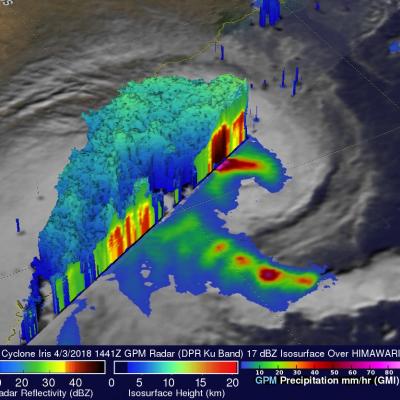
IRIS has taken a long, fluctuating and serpentine trek since the tropical cyclone formed in the Coral Sea northeast of Australia on March 24. For a while IRIS weakened and was downgraded to a tropical low. The tropical low moved toward the northeastern coast of Australia and was upgraded again to tropical cyclone IRIS on April 2. The tropical cyclone has then moved generally southeastward parallel to the Australian coast. This analysis from data collected by Microwave Imager (GMI) and Dual Frequency Precipitation Radar (DPR) instruments shows that extremely heavy rain was falling west of IRIS'