Missions

GPM flying over Earth with a data swath visualized.
The Visible and Infrared Scanner (VIRS) is one of the primary instruments aboard the Tropical Rainfall Measuring Mission (TRMM) observatory. VIRS is one of the three instruments in the rain-measuring package and serves as a very indirect indicator of rainfall. It also ties in TRMM measurements with other measurements that are made routinely using the meteorological Polar Orbiting Environmental Satellites POES) and those that are made using the Geostationary Operational Environmental Satellites (GOES) operated by the United States. VIRS, as its name implies, senses radiation coming up from the...
GPM flying over Earth with a data swath visualized.
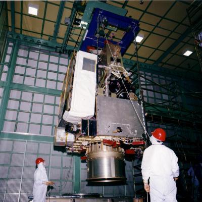
Diagram of the GPM Core Observatory Carrying both a dual frequency radar instrument and a passive microwave radiometer, the Core Spacecraft serves as a calibration standard for the other members of the GPM spacecraft constellation. The Core Spacecraft was developed and tested in-house at NASA Goddard Space Flight Center. The GPM Core Observatory orbit inclination of 65 degrees is such that it enables the orbit to cut across the orbits of other microwave radiometers, sample the latitudes where nearly all precipitation occurs, and sample at different times of day. The GPM Core Observatory GMI...
Engineers at Goddard Space Flight Center constructing the TRMM satellite assembl
The Tropical Rainfall Measuring Mission is the first Earth Science mission dedicated to studying tropical and subtropical rainfall: precipitation that falls within 35 degrees north and 35 degrees south of the equator. Tropical rainfall comprises more than two-thirds of the world's total. The satellite uses several instruments to detect rainfall including radar, microwave imaging, and lightning sensors. Flying at a low orbital altitude of 240 miles (400 kilometers) TRMM's data collection of tropical precipitation helps improve our understanding about climate and weather. The Japanese space...