Data

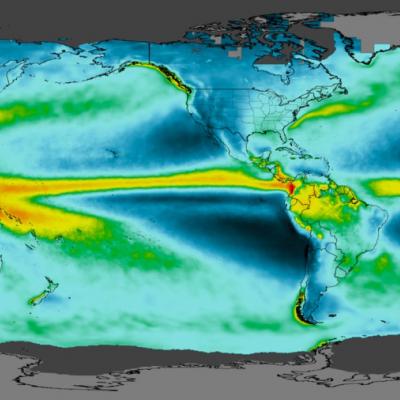
IMERG Grand Average Climatology 2001 - 2019
Map of Earth Showing the GPM Grand Average Climatology.
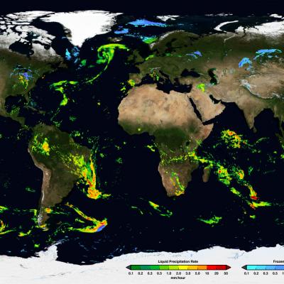
IMERG Early Run Example January 24th, 2020
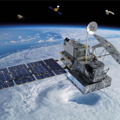
NASA’s Integrated Multi-satellitE Retrievals for GPM (IMERG) algorithm combines information from the GPM satellite constellation to estimate precipitation over the majority of the Earth's surface. IMERG is particularly valuable over areas of Earth's surface that lack ground-based precipitation-measuring instruments, including oceans and remote areas. IMERG fuses precipitation estimates collected during the TRMM satellite’s operation (2000 - 2015) with recent precipitation estimates collected by the GPM mission (2014 - present) creating a continuous precipitation dataset spanning over two decades. This extended record enables scientists to compare past and present precipitation trends, enabling more accurate climate and weather models and a better understanding of Earth’s water cycle and rainfall and snowfall patterns. IMERG also enables a wide range of applications to help communities around the world make informed decisions for disasters, disease, resource management, energy production, food security, and more.
IMERG Early Run Example January 24th, 2020
Thumbnail
GPM Precipitation and Applications Viewer This page is a demonstration of the PMM Precipitation and Applications Publisher API. To learn how to use the API for your own applications, please visit: https://pmmpublisher.pps.eosdis.nasa.gov/ https://pmmpublisher.pps.eosdis.nasa.gov/docs For More Information On: the GPM Precipitation products, please see: https://gpm.nasa.gov/data/directory the Global Landslide Nowcast, please visit: https://gpm.nasa.gov/applications/landslides LOADING Show Legends Show Controls Select Region: North America Central America South America Europe Africa Middle East

Status of TMPA and TMPA-RT

As previously announced, with the recent release of the long-record V06B IMERG Early, Late, and Final products in late summer of 2019, processing of the TMPA-RT and TMPA products is ending, with December 2019 being the final month of data. This means that TMPA-RT products have already ceased production and the TMPA products will end with December 2019 (expected by March 2020). Thanks go to the PPS team, who managed to keep some really old computer hardware alive long enough to meet this goal! These legacy products will continue to be hosted at PPS and GES DISC to allow users sufficient time to
IMERG Early Run Example January 24th, 2020
GPM & TRMM Data Usage Policy GPM and TRMM data are freely available at all levels for which the particular sensor or sensor combination has been processed by GPM. For the GPM Core Observatory this is for Levels 0 through 3 products (as applicable). For the partner satellites in the GPM constellation this is Levels 1c through 3 (as applicable). Users are encouraged to access data from the primary GPM and TRMM archives (i.e. nasa.gov domains at Goddard Space Flight Center). When data from secondary archives are used, it is incumbent on the user to verify that the data values accessed are
IMERG Early Run Example January 24th, 2020
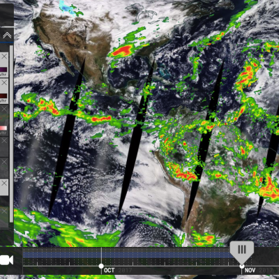
NASA Worldview Example
Learn about different websites and tools that allow you to visualize data from NASA's Global Precipitation Measurement Mission (GPM).