Resources

Thumbnail
a | b | c | d | e | f | g | h | i | j | k | l | m | n | o | p | q | r | s | t | u | v | w | x | y | z Click one of the letters above to advance the page to terms beginning with that letter. A active sensor search for term A remote-sensing sys­tem (e.g., an instrument) that transmits its own radiant energy to detect an object or area for observation and receives the reflected or transmitted energy. Radar is an example of an active system. Compare with passive sensor. algorithm search for term A self-contained step-by-step set of operations to be performed. Scientists use mathematical algorithms
Thumbnail
Permissions for using imagery found on this website are the same as those listed in NASA's official Media Usage Guidelines For questions about permission for using NASA images and videos, please refer to NASA's official Media Usage Guidelines . For any additional questions please contact bert.ulrich@nasa.gov A few key points of NASA's media usage policy include: NASA content (images, videos, audio, etc) are generally not copyrighted and may be used for educational or informational purposes without needing explicit permissions. The NASA insignia logo (the blue "meatball" insignia), the retired
GPM Earth Day 2020 Banner
On April 22, 2020, people around the world will celebrate the 50th anniversary of Earth Day, embracing our commitment towards understanding the planet’s environmental processes and protecting it for future generations. In support of this global event, NASA is highlighting the agency’s contributions to the environment with a week of online events, stories, and resources.
3D Printed GPM Data  from Typhoon Malakas
Overview Precipitation data from the Global Precipitation Measurement mission (GPM) was used to generate these 3D printed models of various tropical cyclones and storm systems from the past several years. This data was collected by GPM's Dual-frequency Precipitation Radar instrument, which utilizes Ka-band and Ku-band frequencies to measure the size, shape, and distribution of liquid and solid water particles within clouds in three dimensions. The raw radar data was then processed by algorithms at NASA's Precipitation Processing System to be converted to precipitation rates, then was further
Thumbnail
Frequently Asked Questions Get answers to some of the more frequently asked questions about the GPM and TRMM missions and precipitation measurement in general. Image Gallery Photos and illustrations from GPM, TRMM, and the Ground Validation missions. Video Gallery Videos and animations from GPM, TRMM, and the Ground Validation missions. Documents View the PMM document repository, in which you can download scientific papers and other documents from GPM, TRMM, and the Ground Validation missions. GPM Refereed Publications TRMM Refereed Publications Lists of published research articles from the
Signs of Spring banner
The Global Precipitation Measurement mission is happy to announce the top winners of the "Signs of Spring" photo competition. Thank you to everyone who submitted their best pictures of spring precipitation. From March 30th through April 27th, 2015, over 800 photos were submitted via Flickr and Instagram. We loved all of your entries and thoroughly appreciate your participation. We'll be sending the winning submitters GPM posters, lithographs, pins, and NASA and GPM stickers. Stay tuned and follow GPM for information about future events and contests. Learn More About GPM
gpm-signs-of-spring-photo-contest
Spring is in the air, and with it lots of precipitation. The Global Precipitation Measurement mission (GPM), launched in February 2014, measures Earth’s precipitation from above using a constellation of satellites. GPM can tell us where and how much it is raining and snowing so we can learn more about Earth’s water cycle, better model our weather and climate, and predict floods, droughts, hurricanes, and more. As GPM watches spring weather from above, we want to see what spring looks like to you! Get out your cameras and show us the signs of spring in your area - from April showers to dew...
GPM Launches Hands-On Field Campaign for Students
This spring, students worldwide are invited to grab rain gauges and learn how scientists use ground measurements to validate satellite precipitation data. NASA's Global Precipitation Measurement, or GPM, mission is partnering with the Global Learning and Observations to Benefit the Environment (GLOBE) program to conduct a field campaign where students will measure rain and snow in their hometowns from Feb. 1 through mid-April 2015 and then analyze the data. A webinar for teachers to learn more about the campaign and how to participate is scheduled for Jan. 21, 2015. GLOBE is a worldwide hands...
Goddard Intern Analyzing Snowfall Data for GPM
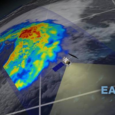
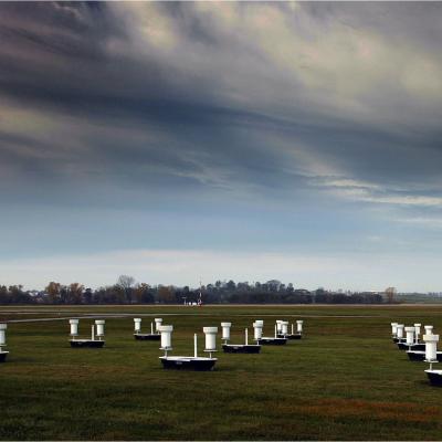
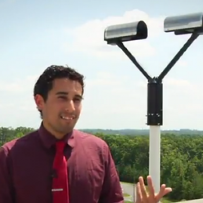
Summer intern Jorel Torres, a graduate student from the South Dakota School of Mines and Technology, talks about snow research and the value of hard work, persistence, and passion. Snow awes and annoys, brings nostalgia or abhorrence. For Jorel Torres, snow makes him curious—so much that he studies it. For the past ten weeks, Torres compared various ground measurements of snow to data from NASA’s Global Precipitation Measurement mission as an intern at NASA’s Goddard Space Flight Center. The snow, Torres said, is important to the Earth’s hydrological cycle as it is more unpredictable, thus...
GPM Selects Master Teachers
NASA's Global Precipitation Measurement, or GPM, mission recently completed a competitive process to select 25 teachers from around the world for its Master Teacher Program. The chosen educators will develop educational resources based on GPM's data – with a focus on the water cycle and related applications – to share with their students and school communities. "Our goal is to make teachers aware of the wealth of resources offered through NASA education and outreach. We also will receive feedback on how their students received the material," said Dorian Janney, education specialist and manager...