

More Rain and Flooding in California
The West Coast is once again feeling the effects of the "Pineapple Express". Back in early January one of these "atmospheric river" events, which taps into tropical moisture from as far away as the Hawaiian Islands, brought heavy rains from Washington and Oregon all the way down to southern California. This second time around, many of those same areas were hit again. The current rains are a result of 3 separate surges of moisture impacting the the West Coast. The first such surge in this current event began impacting the Pacific coastal regions of Washington, Oregon, and northern California on the 15th of February.
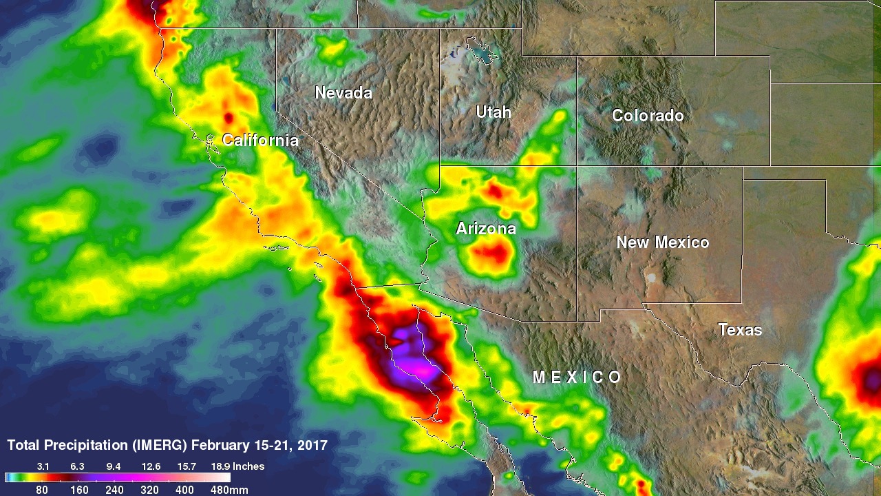
The Integrated Multi-satellitE Retrievals for GPM or IMERG is used to estimate precipitation from a combination of passive microwave sensors, including GPM's GMI microwave sensor and geostationary IR (infrared) data. This first image shows accumulated IMERG rainfall estimates for the period 00:30 UTC 15 to 23:00 UTC 21 February 2017. The initial surge was responsible for bringing part of the rainfall (up to about 2 to 3 inches) shown over the coastal regions southwestern Oregon and northern California. The next surge of moisture began to arrive on the 17th and brought moderate to somewhat heavy rain initially to parts of the northern Sacramento Valley and along and inward from the coast from about Big Sur southward to Los Angeles before delivering even heavier rainfall farther southward along the coast into Baja California where up to 7 to 10 inches is estimated to have fallen (shown in purple and pink). This surge was also responsible for bringing moderate to heavy rains (about 2 to 4 inches, shown in yellow and red) to parts of Arizona.
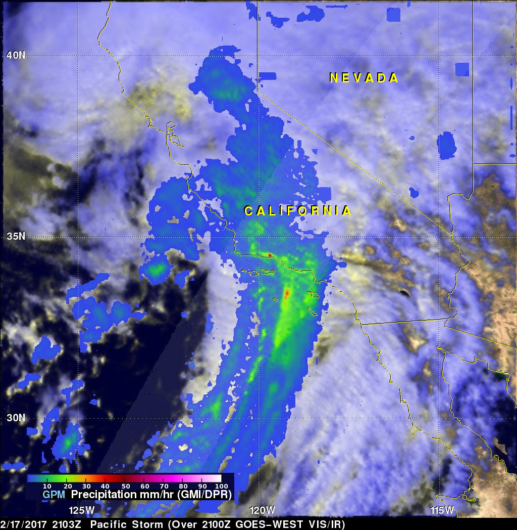
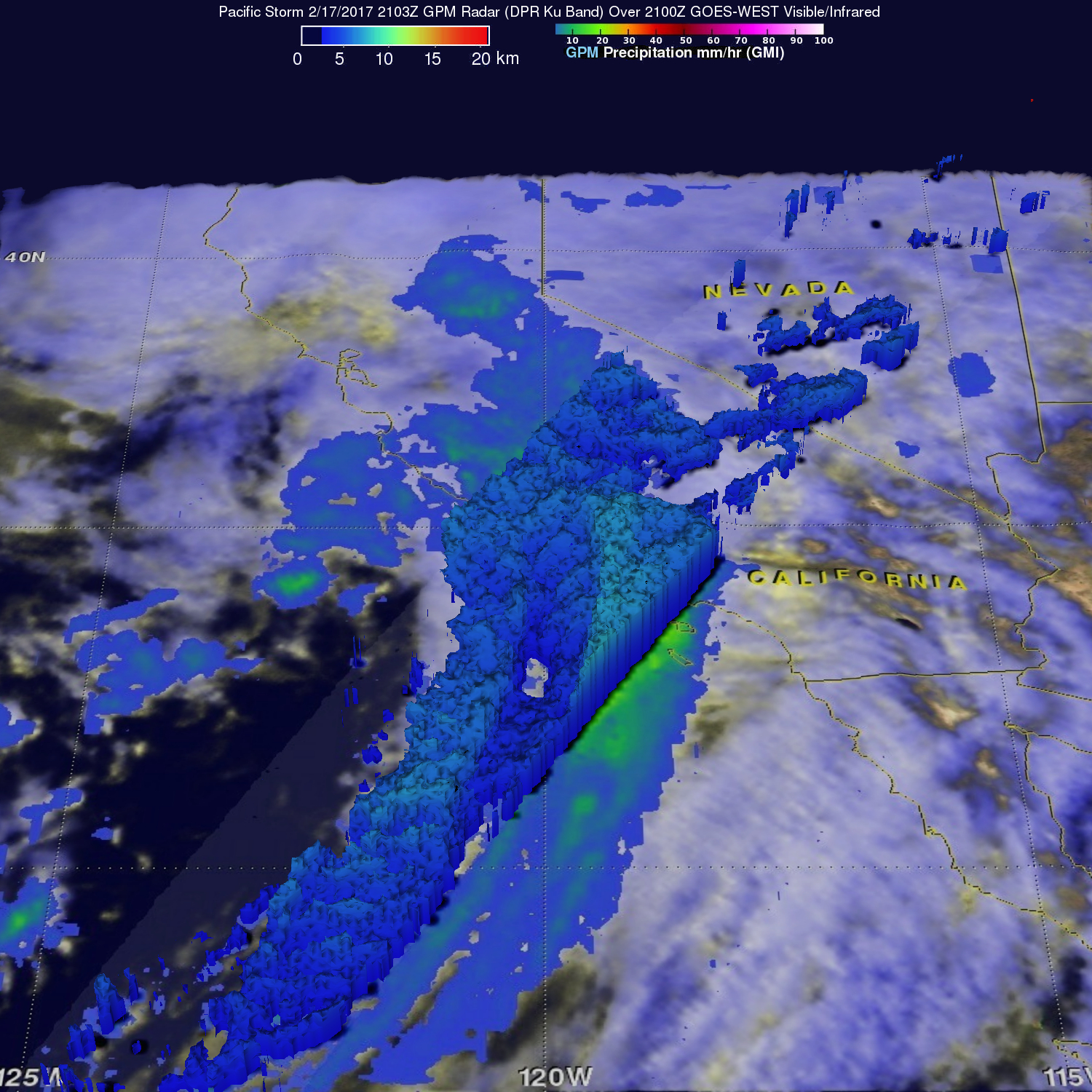
This next image shows rain rates derived from the GMI microwave imager (outer swath) and dual-frequency precipitation radar or DPR (inner swath) overlaid on enhanced VIS/IR data from the GOES-West satellite. The image was taken at 21:03 UTC (1:03 pm PST) on the 17th of February and shows the long plume of mostly moderate rain (green areas) streaming northward into the coast around Los Angeles in association with this second surge. GPM's DPR can also provide details on storm structure. This third image shows precipitation top heights corresponding to the previous image. The storms tops are all relatively shallow (generally below 7 km, shown in blue) with the highest only reaching just over 8 km (shown in lighter blue). The bulk of the rain accumulation is due to the steady, non-stop nature of this relatively shallow, moderate rain and the effects of orographic enhancement and not to intense thunderstorm activity.
The final and most recent surge of moisture began making its way ashore in and around central California closer to the San Francisco Bay area on the 20th, bringing rain to the Bay Area as well as farther north along the coast and enhancing the rainfall totals over the Sacramento Valley and coastal northern California and southwest Oregon.
Despite the ongoing flood warnings for most of the Sacramento Valley, this current event is winding down with drier conditions forecast for the end of the week; however, another storm system if also forecast to impact the region over the weekend.
Images produced by Hal Pierce (SSAI/NASA GSFC) and caption by Steve Lang (SSAI/NASA GSFC).