Articles

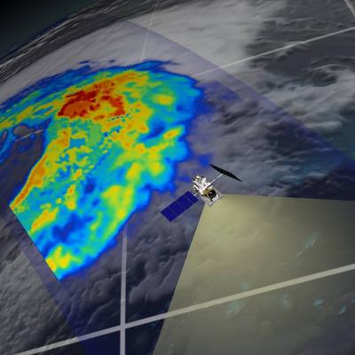
GPM flying over Earth with a data swath visualized.
A GPM Ground Validation prototype is currently underway to compare TRMM satellite data to similar measurements from the national network of operational weather radars. The goal of the Validation Network is to identify and resolve significant discrepancies between the US national network of ground radar observations and satellite observations. The validation network prototype matches-up TRMM Precipitation Radar (PR, see below image) and quality-controlled NEXRAD reflectivity data (right) for 21 ground radar sites in the Southeastern United States. Conceptually, the Validation Network also...
GPM flying over Earth with a data swath visualized.
Diagram of the GPM Core Observatory Carrying both a dual frequency radar instrument and a passive microwave radiometer, the Core Spacecraft serves as a calibration standard for the other members of the GPM spacecraft constellation. The Core Spacecraft was developed and tested in-house at NASA Goddard Space Flight Center. The GPM Core Observatory orbit inclination of 65 degrees is such that it enables the orbit to cut across the orbits of other microwave radiometers, sample the latitudes where nearly all precipitation occurs, and sample at different times of day. The GPM Core Observatory GMI...
GPM flying over Earth with a data swath visualized.
Malaria outbreaks after the 2010 floods in Pakistan, E. coli and colliform from raw sewage in Mississippi flood waters, and cholera spread by heavy rains in Cameroon, West Africa are among the many health hazards associated with flood disasters and torrential rains. In developing regions with limited clean water infrastructure and health resources that are stretched thin, any advanced warning can make a huge difference in the health community’s response to help people in need. Flooding in Gonaives Haiti before and after the 2004 tropical storm Jeanne Using satellite data to forecast disease...
GPM flying over Earth with a data swath visualized.
Soil moisture content is a measure of the amount of water in the soil. Knowing how much water is held in the soil is useful for many applications, including improving agricultural productivity, assessing drought and flood conditions, and even estimating groundwater supplies. NASA has teamed with the U.S. Department of Agriculture (USDA) - Foreign Agricultural Service (FAS) to develop a global soil moisture map fashioned for FAS by integrating soil moisture observations from the Earth Observing System Advanced Microwave Scanning Radiometer (AMSR-E) instrument into the USDA FAS soil moisture...
GPM flying over Earth with a data swath visualized.
Visit the Land Data Assimilation Systems homepage Rain and snowfall are key components of land surface models, including the Land Data Assimilation Systems (LDAS), which integrate satellite and ground-based observational data to generate estimates of soil moisture, soil temperature, evapotranspiration and runoff. Scientists use this and other models to study surface features and how they change due to manmade and natural conditions such as urbanization and erosion. The Global LDAS (GLDAS) uses TRMM precipitation data in numerous investigations into how water and energy cycle through natural...